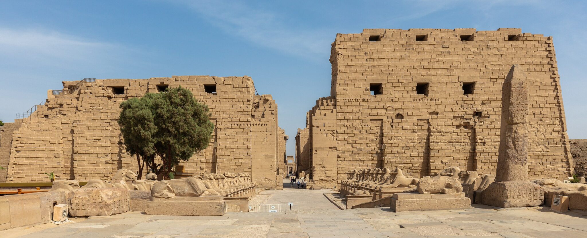
For more than three millennia, Karnak has stood as the spiritual core of ancient Egypt. Now, a new scientific study suggests that its significance may run even deeper—rooted not only in theology, but in the very landscape from which it emerged.
According to groundbreaking geoarchaeological research, the temple complex may have been deliberately founded on land that physically rose from water, echoing one of ancient Egypt’s most powerful creation myths.
The study, led by researchers from Uppsala University and published in Antiquity, presents the most detailed reconstruction to date of the ancient environment beneath Karnak. The findings suggest that the site was built atop a rare island of elevated ground shaped by shifting channels of the Nile River—a geological setting that closely mirrors Egyptian cosmogony.
A Sacred Landscape Shaped by Water
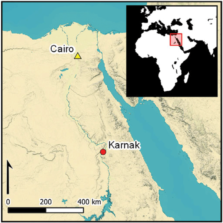
Today, Karnak lies within the modern city of Luxor, roughly 500 meters east of the Nile. Thousands of years ago, however, the river’s course looked very different.
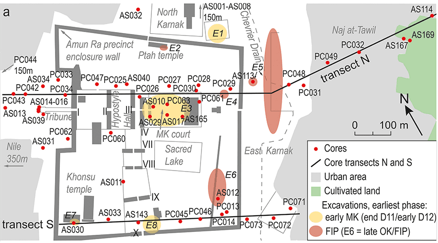
To reconstruct this lost landscape, the research team analyzed 61 sediment cores taken from within and around the temple precinct, alongside tens of thousands of ceramic fragments. This extensive dataset allowed them to trace how river channels shifted, land surfaces formed, and human activity gradually intensified.
The results show that before about 2520 BCE, the Karnak area was regularly flooded by fast-moving Nile waters, making permanent construction impossible. Only later, during the Old Kingdom, do the earliest traces of sustained human presence appear—supported by pottery dating between roughly 2305 and 1980 BCE.
At the heart of the discovery is a naturally elevated terrace formed when Nile channels cut along both the eastern and western sides of the site. This process created a stable “island” of high ground, surrounded by water—an extremely rare feature in the flood-prone Theban region.
From River Island to Monumental Temple
This elevated landform provided a secure foundation for early settlement and the first construction phases at Karnak. As centuries passed, river channels gradually migrated, exposing more land and allowing the temple complex to expand into the vast architectural landscape seen today.
One of the study’s most striking findings concerns the eastern river channel, long overlooked in previous research. Evidence shows that it remained active until the Roman period, far longer than expected.
Researchers also identified signs of deliberate human intervention. Parts of this channel appear to have been intentionally filled with desert sand—a likely effort by ancient builders to stabilize the terrain and accelerate temple expansion.
When Geography Becomes Theology
Beyond geology, the study opens a compelling window into ancient Egyptian belief.
In Egyptian creation mythology, the world begins with the emergence of a primeval mound from the chaotic waters of Nun. From this first solid ground, creation unfolds and the creator god appears.
The reconstructed landscape beneath Karnak aligns remarkably well with these narratives. The identified island is the only known naturally elevated landform in the Theban area that was once completely encircled by water.
Researchers suggest that this was no coincidence. Theban elites may have deliberately selected Karnak as the cult center of Ra-Amun precisely because the landscape embodied the moment of creation itself—land rising from water.
Middle Kingdom texts reinforce this symbolism, describing the primeval mound emerging from the “Waters of Chaos.” Each year, as Nile floodwaters receded, the elevated ground at Karnak would have visually reenacted this myth, transforming seasonal change into a sacred spectacle.
Engineering Nature, Embedding Meaning
The research also ties Karnak’s development to broader environmental changes in the Nile Valley. It builds on recent climate studies showing how shifting rainfall patterns and river dynamics reshaped Egypt’s landscapes over thousands of years.
Together, these findings challenge the idea of ancient Egyptians as passive inhabitants of their environment. Instead, they reveal a society that actively understood, adapted to, and reshaped natural forces—embedding religious meaning directly into the land itself.
Conducted under the auspices of the Egypt Exploration Society with approval from Egypt’s Ministry of Tourism and Antiquities, the study highlights the growing role of interdisciplinary science in reinterpreting iconic ancient monuments.
Where Myth and Earth Converge
Seen through this lens, Karnak is more than a masterpiece of stone architecture. It is a deliberate fusion of myth, landscape, and human engineering—a place where belief was not only expressed through ritual, but literally grounded in the earth.
If the new findings are correct, the temple did not simply honor creation. It was built to become it.
Benjamin Thomas Pennington, Angus Graham, Aurélia Masson-Berghoff, Marie Millet, Jan Peeters, Willem H.J. Toonen, Timotheus G. Winkels, Luke H. Sollars, Virginia L. Emery, Kristian David Strutt, Dominic Simon Barker. Conceptual origins and geomorphic evolution of the temple of Amun-Ra at Karnak (Luxor, Egypt). Antiquity, 2025; 99 (408): 1535 DOI: 10.15184/aqy.2025.10185
Cover Image Credit: View of the first pylon of the temple of Amun-Re at Karnak. Public Domain – Wikipedia Commons