
Roman gold mines do not always reveal themselves through glittering treasure. In Spain’s Eastern Pyrenees, their traces survived in a quieter form: river terraces, carved slopes, and sediment buried inside an ancient water system that had not been dated until now.
In Spain’s Eastern Pyrenees, researchers have now confirmed that such traces belong to a Roman gold mining landscape. A new study by scientists from the University of A Coruña and the Autonomous University of Barcelona has identified Roman-era alluvial gold extraction at Les Guilleteres d’All, in Cerdanya, Girona.
The evidence did not come from a hoard of coins or a glittering artifact. It came from buried sediment inside an ancient hydraulic reservoir. Using optically stimulated luminescence, or OSL dating, researchers were able to show that the reservoir was part of a Roman mining system and was likely abandoned around the late second or early third century CE.
For the archaeology of the Pyrenees, this is a significant shift. Scholars had long suspected that Rome exploited gold in this mountain region. Now, for the first time, the landscape has provided direct chronological evidence.
A Roman goldfield hidden in the mountains
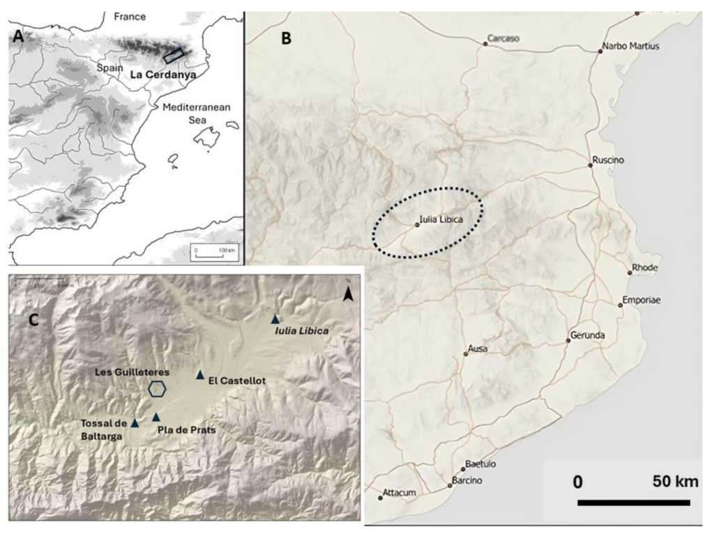
Les Guilleteres d’All lies in the high Cerdanya Valley, a Pyrenean basin surrounded by mountains that rise toward 2,900 meters. In antiquity, this was not an isolated backwater. It was a strategic zone between Hispania and southern Gaul, crossed by routes, watched by Roman power, and tied to the nearby city of Iulia Libica, present-day Llívia.
The region’s rivers carried tiny particles of gold from older geological deposits into alluvial terraces. The Segre River and its tributaries were especially important. Medieval Islamic sources later praised the quality of Segre gold for coinage, while ancient authors had already hinted at gold from the Pyrenees.
Yet knowing that gold existed is not the same as proving how it was mined.
Across Les Guilleteres, archaeologists identified deep cuts, ravines, and open extraction fronts that did not match natural erosion. Their form pointed to Roman hydraulic mining, a technique that used controlled water flow to break down gold-bearing sediment.
The land had been worked, not merely weathered.
Water was the Roman machine
Roman mining relied on more than picks and manpower. In goldfields, water often did the hardest work.
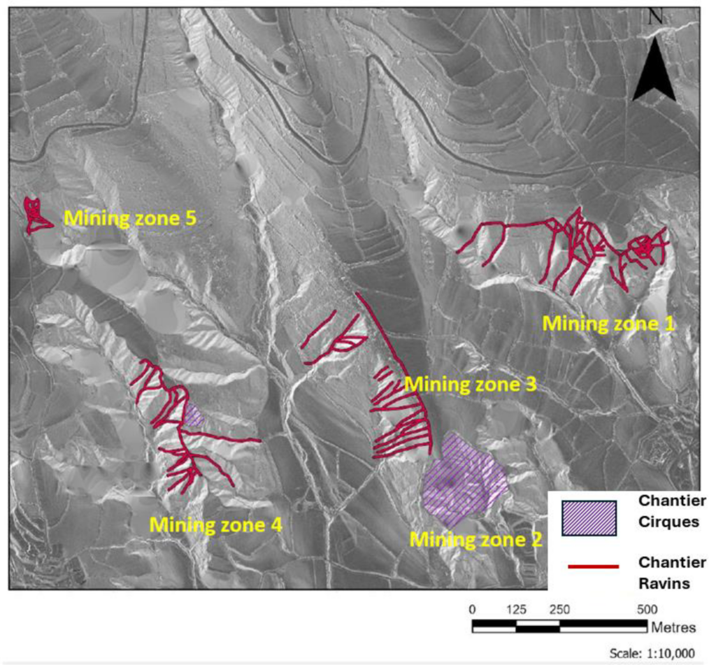
At Les Guilleteres, researchers identified hydraulic mining structures known as chantier-ravins and chantier-cirques. These were open extraction zones where water was collected, directed, and released across slopes. The force of that water eroded clay and marl deposits, freeing heavier gold particles that could then be recovered from the washed sediment.
One of the largest extraction fronts at the site measures about 300 meters across. The total volume of earth removed from Les Guilleteres has been estimated at roughly 2 million cubic meters.
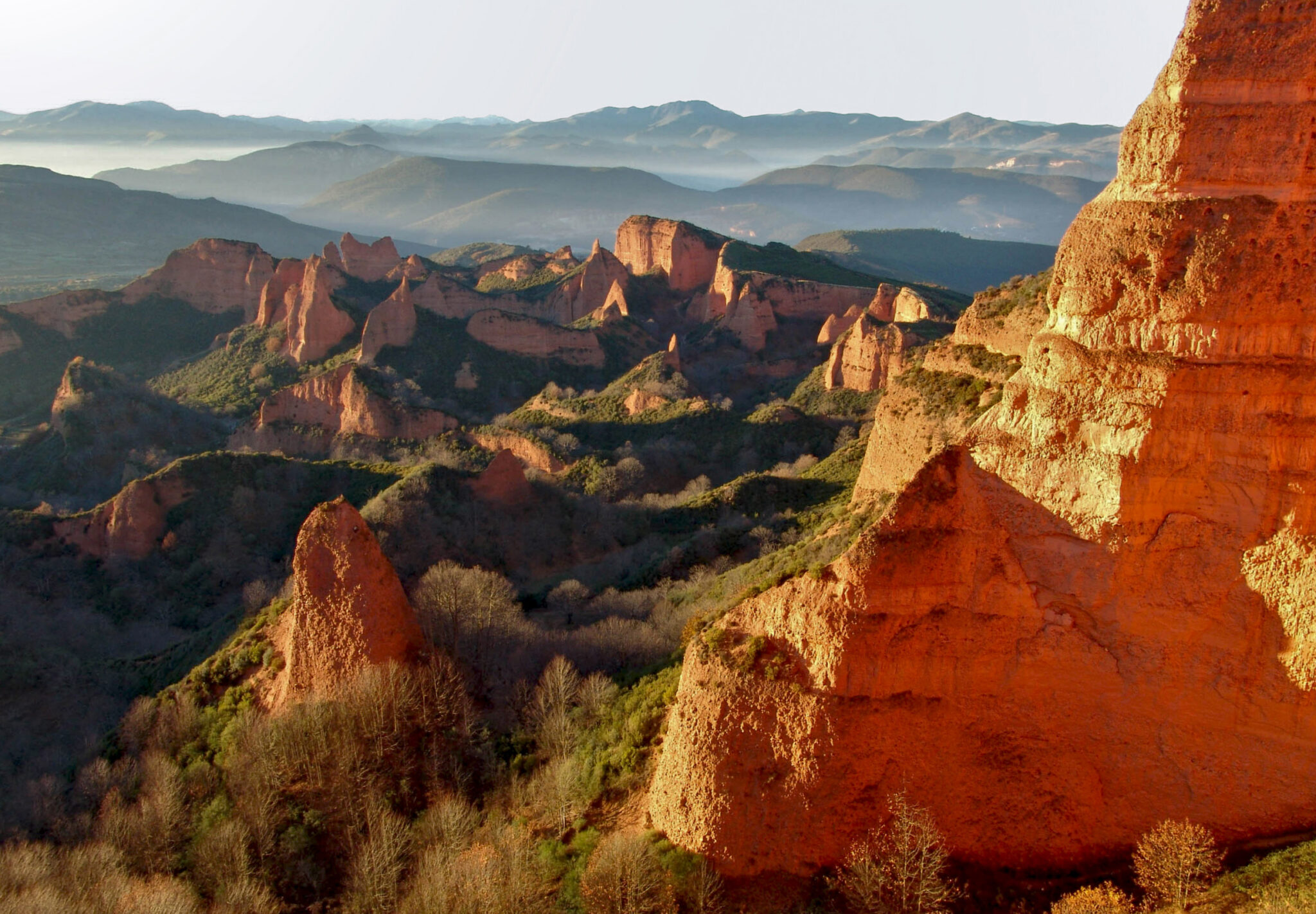
That is smaller than the monumental Roman mining landscapes of northwestern Spain, especially Las Médulas. But the scale remains impressive for a mountain setting. It required planning, labor, reservoirs, channels, and technical control over water.
One of those reservoirs became the key to dating the mine.
The buried reservoir that solved the mystery
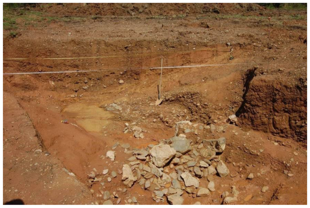
Excavations at Les Guilleteres uncovered a water-control structure connected to the mining system. The excavated ditch measured about 4.5 meters wide and reached 1.5 meters deep. A dam built from large stone blocks helped retain and manage the water. Smaller stones formed parts of the reservoir edges.
Earlier work recovered two pottery fragments from sediment deposited at the bottom of the structure. One belonged to the early Roman Imperial period, between the first and second centuries CE. The other was Bronze Age, showing older human activity nearby but not dating the mine itself.
That left a problem. The site looked Roman. The engineering looked Roman. The wider historical context pointed to Rome. But the mine still needed a more secure date.
In 2022, the research team opened a new trench in the reservoir and collected fine-grained sediments from lower layers. These sediments had likely settled after the hydraulic system stopped functioning, when still water began filling the abandoned structure.
Instead of dating charcoal, bone, or organic material, the team dated the sediment itself.
Light trapped in ancient quartz
OSL dating measures when mineral grains, especially quartz, were last exposed to sunlight. When sediment is transported in daylight, its internal signal is reset. Once buried, the grains begin storing energy from natural radiation in the surrounding soil. In the laboratory, that stored signal can be measured.
For Les Guilleteres, the method was especially useful because the reservoir did not preserve enough organic material for traditional radiocarbon dating.
The results produced broad but meaningful chronological ranges. Combined with the pottery evidence, the Roman form of the hydraulic structures, and the nearby settlement pattern, they confirm that Les Guilleteres belonged to a Roman mining landscape. The researchers argue that the system was probably abandoned no later than the late second or early third century CE.
That makes the discovery more than a technical dating result. It places the mine inside a larger story of Roman expansion, resource extraction, and urban decline in the Pyrenees.
Iulia Libica and Rome’s mountain economy
About 12 kilometers from the mines stood Iulia Libica, the only Roman city documented in the Pyrenees. Its position was no accident. From this mountain city, Roman authorities could monitor routes, people, and resources across a strategically important territory.
The connection between Iulia Libica and the mines cannot yet be proven in administrative terms. Still, the evidence is suggestive.
At El Castellot de Bolvir, researchers have identified a metallurgical workshop linked to gold, silver, lead, and cinnabar production. At Pla de Prats, near the mines, a Roman necropolis produced a gold bracelet weighing 23 grams, an unusually rich object for a high mountain region.
Together, these finds point to a landscape where metal, status, and Roman control intersected.
The timing is also important. Archaeological evidence shows that Iulia Libica began to decline from the late second or early third century CE. Parts of its forum and domestic areas were abandoned. That period closely matches the likely abandonment of the Les Guilleteres mining system.
The study does not claim a simple cause and effect. But a hydraulic gold mine needed organization, maintenance, labor, and authority. If the nearby urban center weakened, the infrastructure behind the mine may have weakened as well.
A discovery written into the landscape
The confirmation of Roman gold mining at Les Guilleteres adds a new chapter to the history of Roman Hispania. It shows that the search for gold reached deep into the Pyrenees, beyond the better-known mining regions of northwestern Spain.
It also shows how modern archaeology can read evidence that is easy to miss. At Les Guilleteres, the proof was not a spectacular object. It was a reservoir, a dam, engineered ravines, and quartz grains that preserved the memory of burial.
Nearly 1,800 years after Roman waterworks fell out of use, light trapped inside ancient sediment has revealed what the mountains had kept: Rome once came to the Eastern Pyrenees for gold.
Sanjurjo-Sánchez, J., Morera Camprubí, J., & Vila, O. O. (2025). First Evidence of Roman Gold Mining Obtained by Luminescence Dating of Sediments in Les Guilleteres D’All (Cerdanya, Girona, Eastern Pyrenees). Land, 14(9), 1912. https://doi.org/10.3390/land14091912
Cover Image Credit: Landscape of Las Médulas, Spain, the result of hydraulic mining on a vast scale by the ancient Romans. Public Domain