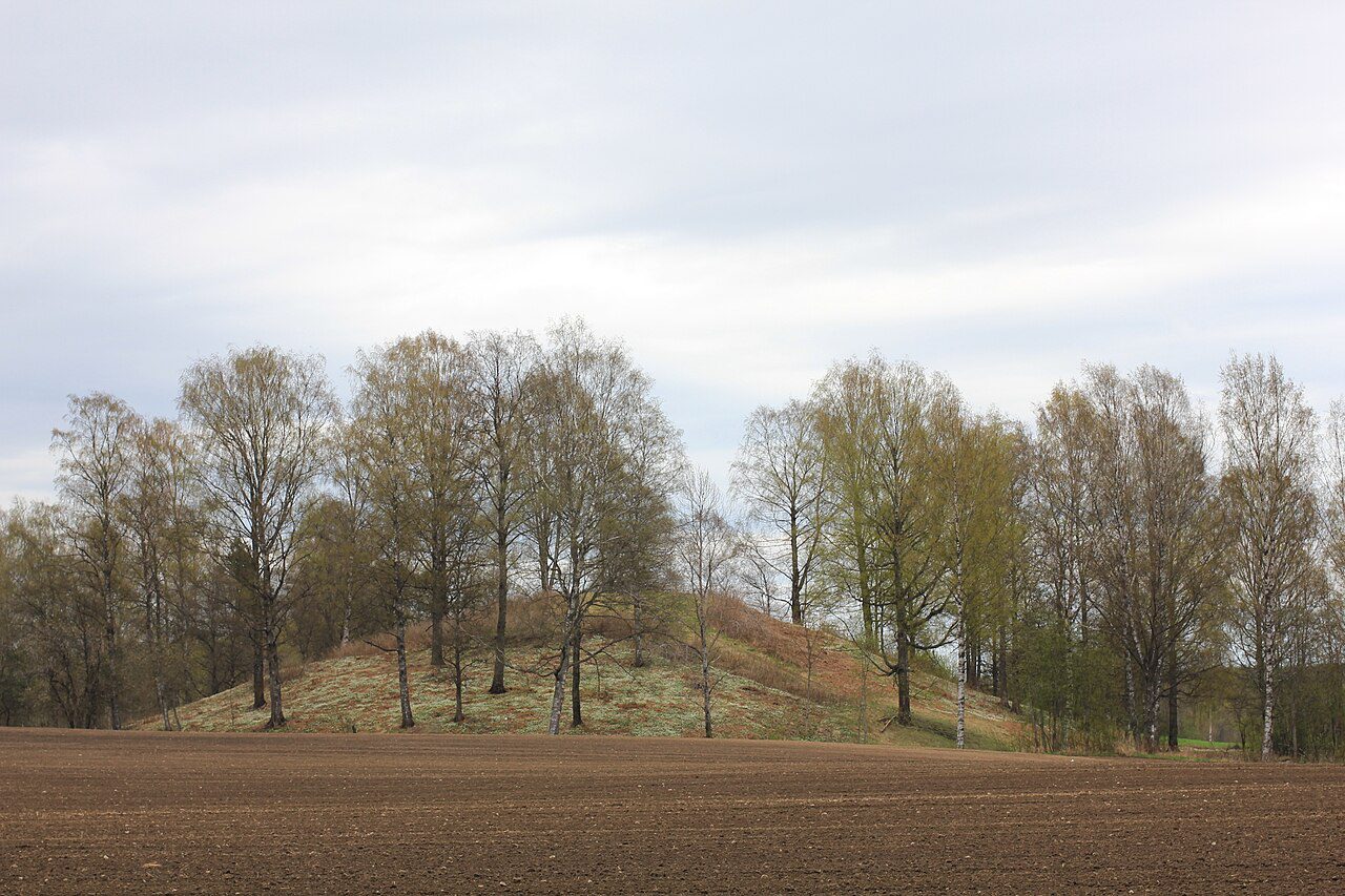
Raknehaugen, one of the largest prehistoric mounds in Scandinavia, has long been interpreted as the burial place of a powerful Iron Age elite. Yet despite more than a century of excavation, no confirmed grave has ever been identified within the monument in Norway. A new study suggests that this enormous structure may not have been built for a king at all, but instead represents a collective response to environmental disruption.
The reinterpretation comes from archaeologist Lars Gustavsen and has been published in the European Journal of Archaeology. By combining earlier excavation data with LiDAR-based landscape analysis, the research shifts attention away from the mound’s interior and toward its surrounding terrain.
A Monument Without a Burial
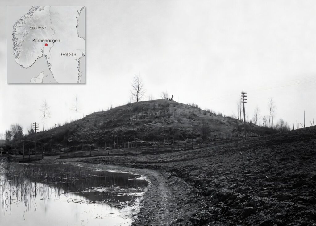
Located about 40 kilometers northeast of Oslo, Raknehaugen originally stood around 15 meters high and measured approximately 77 meters across. Mounds of this scale in Iron Age Scandinavia are typically associated with elite burials, which explains why the monument has long been understood in this way.
However, excavations led by Anders Lorange in the nineteenth century and later by Sigurd Grieg in the twentieth century both reached the base of the structure without uncovering a central burial. This persistent absence has remained one of the most difficult aspects of the traditional interpretation.
An Unusual Structure
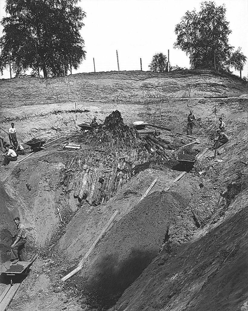
The mound’s construction has also long been considered unusual. Rather than a single engineered burial chamber, it consists of multiple phases involving turf, alternating layers of clay and sand, and large timber frameworks. The final phase alone incorporated tens of thousands of logs arranged in a tent-like formation before being sealed beneath layers of soil.
Earlier researchers described the structure as irregular and poorly organized, a characterization that contrasts sharply with known elite burial monuments. The impression is not of a carefully planned tomb, but of a structure assembled under different conditions.
A Landscape Revealed by LiDAR
LiDAR analysis proved central to the new interpretation. By digitally removing vegetation to reveal subtle terrain features, the method allowed Gustavsen to identify an extensive landslide scar stretching nearly 3.8 kilometers across the landscape. Although barely visible at ground level, the feature becomes clear in digital models and places Raknehaugen within a broader environmental context.
This shift in perspective moves the focus away from what lies inside the mound and toward the landscape in which it was built.
Climate Crisis and Construction Timing
Dendrochronological analysis indicates that most of the timber used in the mound was felled around AD 551, placing its construction shortly after the Dust Veil Event. This period is associated with abrupt cooling, agricultural disruption, and population stress across the Northern Hemisphere.
In southern Scandinavia, such conditions may have destabilized clay-rich soils and contributed to large-scale landslides, providing a possible environmental backdrop for the mound’s construction.
Timber Evidence and Rapid Assembly
The timber itself adds further complexity. Many logs appear to have been broken rather than cleanly cut, while others were uprooted or collected in ways that suggest rapid gathering rather than careful planning.
These features are consistent with the possibility that materials were sourced from a disturbed landscape, potentially including the landslide zone itself. The construction, in this sense, reflects urgency rather than monumentality.
Rethinking the Human Remains
Cremated human remains found within the mound were once considered evidence of burial, but radiocarbon dating has shown that they date to between 1391 and 1130 BC, more than a thousand years earlier than the mound’s construction.
This suggests that the remains were incorporated into the mound as part of the soil rather than representing a primary burial, weakening one of the key arguments for interpreting Raknehaugen as a tomb.
A Ritual Monument Rather Than a Tomb
The study does not argue that burial was irrelevant in Scandinavian mound-building traditions, but it challenges the assumption that all large mounds were funerary. Instead, Raknehaugen may represent a ritual monument connected to environmental crisis and collective memory.
While the proposed link between the landslide and the mound cannot be proven directly, the convergence of landscape evidence, construction methods, and chronology offers a compelling alternative to the long-standing interpretation of the site as a royal burial.
Cover Image Credit: Raknehaugen; photo by Tommy Øyvind Holmstad/Wikipedia