

High in the mountains of northern Portugal, a new study on megalithic burial mounds in Serra do Laboreiro is revealing why prehistoric communities consistently chose elevated terrain for their monuments—challenging long-held assumptions about visibility, territory, and landscape use.
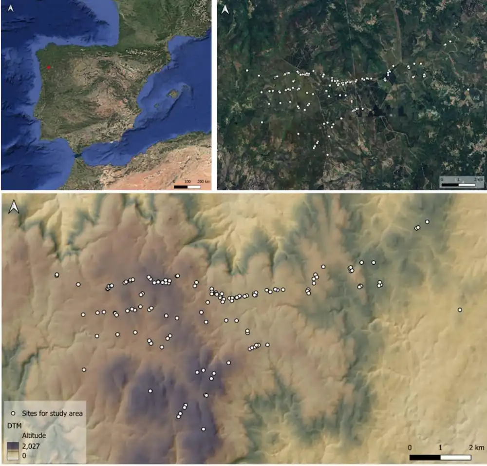
Stretching along the natural border between Portugal and Galicia in Spain, Serra do Laboreiro preserves hundreds of stone-built funerary mounds dating back more than 6,000 years. For decades, archaeologists have debated why these monuments appear in such specific locations. Rather than excavating the mounds themselves, the new research turns to the surrounding terrain, uncovering a clear pattern behind their placement.
A Landscape Shaped by Intentional Choices
Instead of focusing on what lies beneath the mounds, researchers examined how these structures relate to the broader landscape—a method central to landscape archaeology. The goal was simple: determine whether the monuments were placed randomly or according to a consistent spatial logic.
To achieve this, the team used LiDAR technology, which maps the ground using laser pulses and can detect subtle features even beneath dense vegetation. This allowed them to refine earlier records and verify monument locations with high precision.
Out of 269 previously documented sites, only 178 were confirmed as genuine prehistoric burial mounds after duplicates and uncertain entries were removed. This refined dataset formed the basis for a detailed spatial analysis.
Data Reveals a Clear Pattern
Researchers tested eight environmental variables, including elevation, slope, proximity to ridgelines, distance to rocky outcrops, and the nature of the visible horizon. These real monument locations were then compared with nearly one thousand randomly generated points across the same region.
The results were decisive. Seven out of eight variables showed strong statistical significance, demonstrating that the monuments were deliberately placed rather than randomly distributed.
What emerged was a consistent pattern: the burial mounds cluster in elevated areas, often near ridges, rocky features, and natural boundaries—locations where the surrounding landscape is clearly defined and visually structured.
Why Height Matters
Among all the variables analyzed, elevation proved to be the most influential factor. The monuments are consistently positioned at higher altitudes than random distribution would suggest.
This indicates a clear preference for high ground. In mountainous environments, elevation provides visibility and prominence, but it may also carry symbolic meaning—especially for funerary monuments intended to endure across generations.
Slope also played a role, suggesting that not just any elevated area was suitable. The terrain had to meet specific conditions, reflecting a deliberate and selective process.
The Horizon, Not the Territory
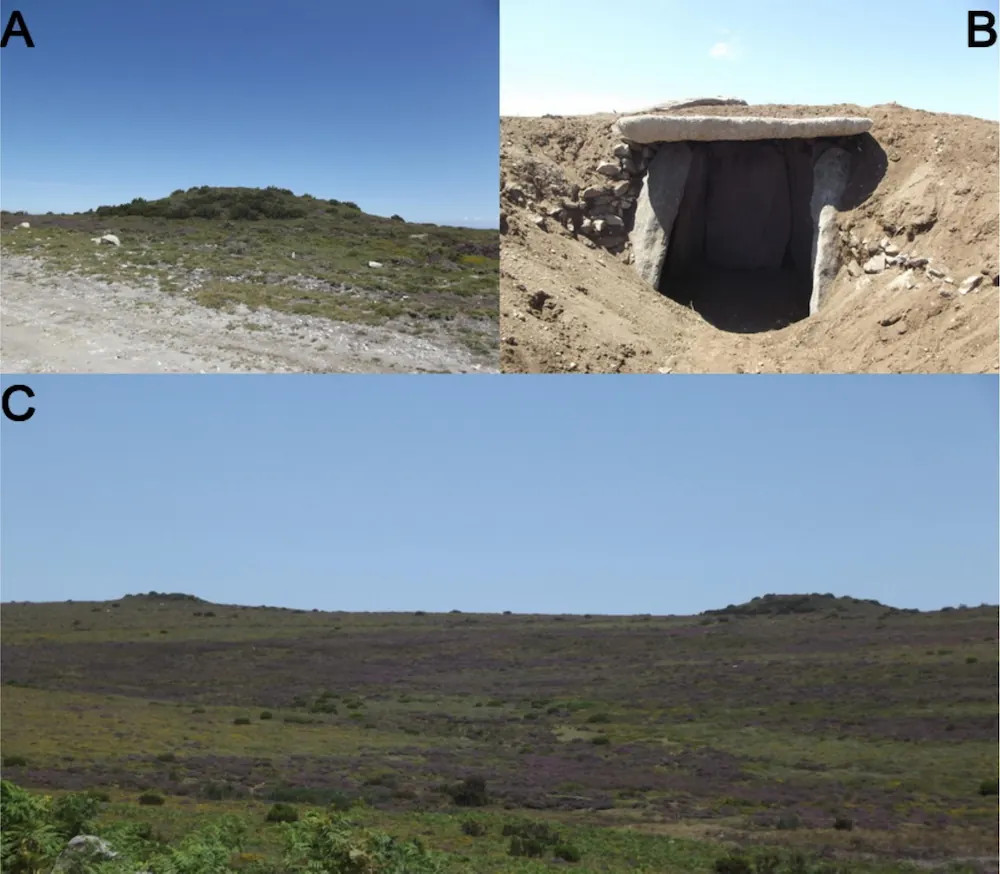
One of the most striking findings challenges a long-standing assumption. While many monuments are located in places with wide, open horizons, the total visible area from each site does not appear to influence their placement.
This distinction is critical. Earlier theories suggested that such monuments were positioned to oversee large territories. The new data suggests otherwise.
Instead, prehistoric builders seem to have been drawn to specific visual features—ridgelines, rock formations, and natural boundaries—that structured how the landscape was experienced. These locations functioned as reference points rather than observation platforms.
More Than Burial Sites
The findings point to a broader role for these monuments. Rather than serving only as burial places, they likely acted as markers within a lived and navigated landscape.
By positioning mounds near natural thresholds—such as ridges and watershed boundaries—prehistoric communities may have been defining territories, movement routes, or socially meaningful zones. In this sense, the monuments did not impose order on the landscape; they revealed and reinforced an existing one.
At the same time, the study highlights an important complexity. These structures were not built all at once. They span thousands of years, meaning different communities may have interpreted and reused the landscape in different ways.
Some areas developed dense clusters of monuments over long periods, while others contain isolated structures in less prominent positions. This variation reflects the dynamic nature of human decision-making, shaped by both environment and cultural change.
A Pattern Seen Across Europe
The spatial logic identified in Serra do Laboreiro is not unique. Similar patterns have been observed across western Europe, where megalithic monuments often cluster in meaningful locations and are reused over generations.
From the Iberian Peninsula to Atlantic France, prehistoric communities appear to have anchored social identity in the physical landscape—transforming natural features into enduring cultural markers.
Limits and Future Research
Despite its insights, the study acknowledges a key limitation: the lack of precise dating for many of the monuments. Because of this, researchers analyzed them as a single dataset, even though they were built across millennia.
Future research combining spatial analysis with more detailed chronological data may reveal how these patterns evolved over time.
A Deliberate Landscape
Even with these limitations, the conclusion is clear. The placement of these 6,000-year-old burial mounds was not accidental. It reflects a complex interaction between human intention, environmental features, and cultural meaning.
Long before maps and formal boundaries, prehistoric communities in Serra do Laboreiro were already shaping the landscape into a structured, meaningful environment—one that continues to be visible thousands of years later.
Lima e Silva, D., Carrero-Pazos, M., Lara-Piñera, F., Fonte, J., & Vilas-Estévez, B. (2026). Spatial insights of the tumular phenomenon in Serra do Laboreiro region (NW Iberian Peninsula). Journal of Archaeological Science: Reports, 72, 105730. https://doi.org/10.1016/j.jasrep.2026.105730
Cover Image Credit: Anta Grande da Comenda da Igreja. Prehistoric Portugal