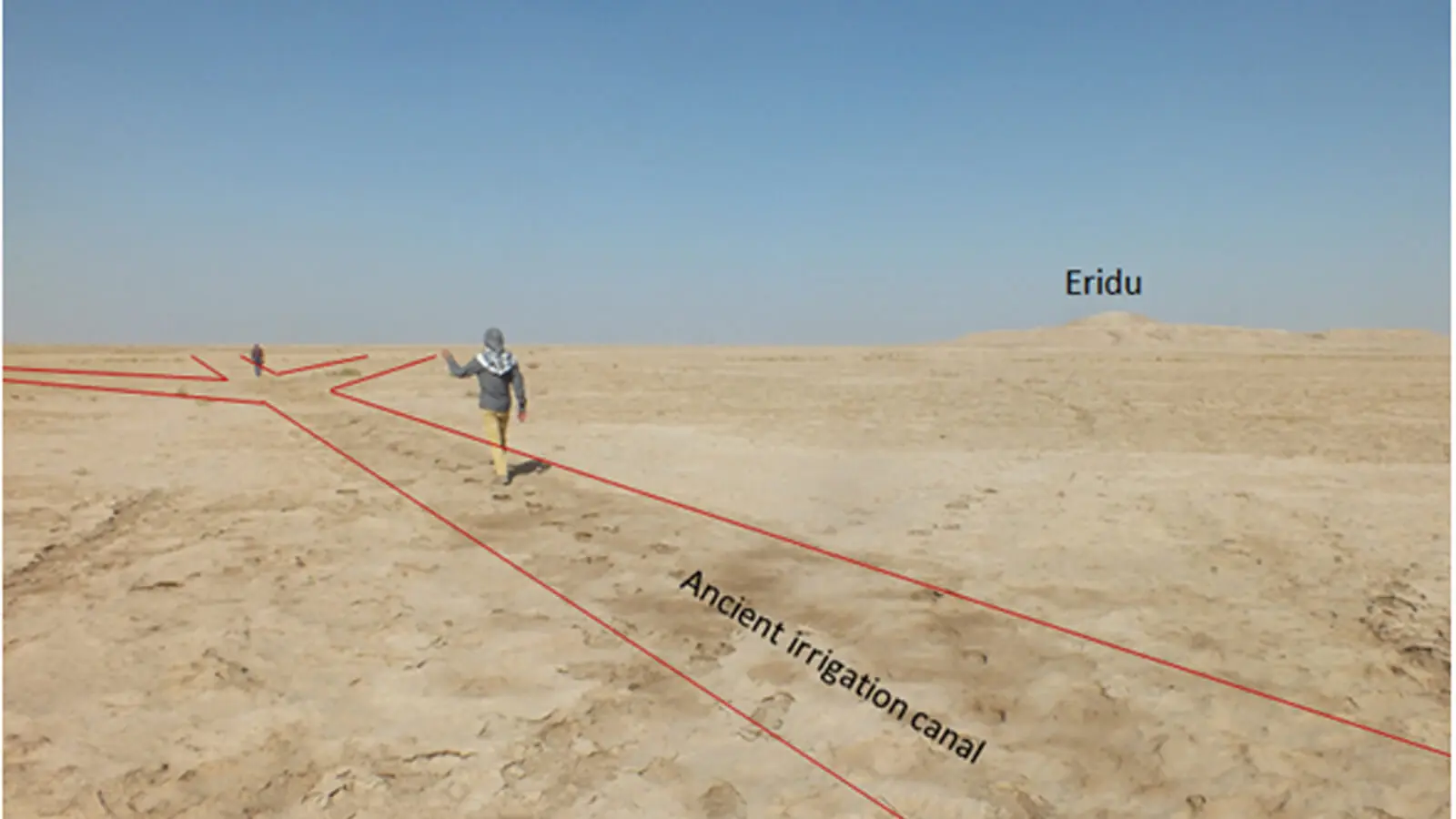
For the first time, researchers have directly dated irrigation features surrounding Eridu, one of southern Mesopotamia’s earliest major settlements. The results show that people were managing water in this part of present-day Iraq as early as the fifth millennium BC.
Published in the journal Iraq, the study examined channels extending from an abandoned course of the Euphrates. The earliest dated feature belongs to between 4540 and 4443 BC, providing rare physical evidence of how Mesopotamia’s first farming communities began reshaping the river landscape.
Ancient Channels Revealed from Space
The channels are difficult to distinguish at ground level. Researchers identified and mapped them using modern high-resolution satellite imagery, Google Earth and declassified CORONA photographs taken in 1968 and 1969.
Some channels crossed or covered others, indicating that the water network changed repeatedly over time. The images allowed the team to follow features as narrow as approximately 50 centimetres and identify five groups of canals and associated water-management features around Eridu.
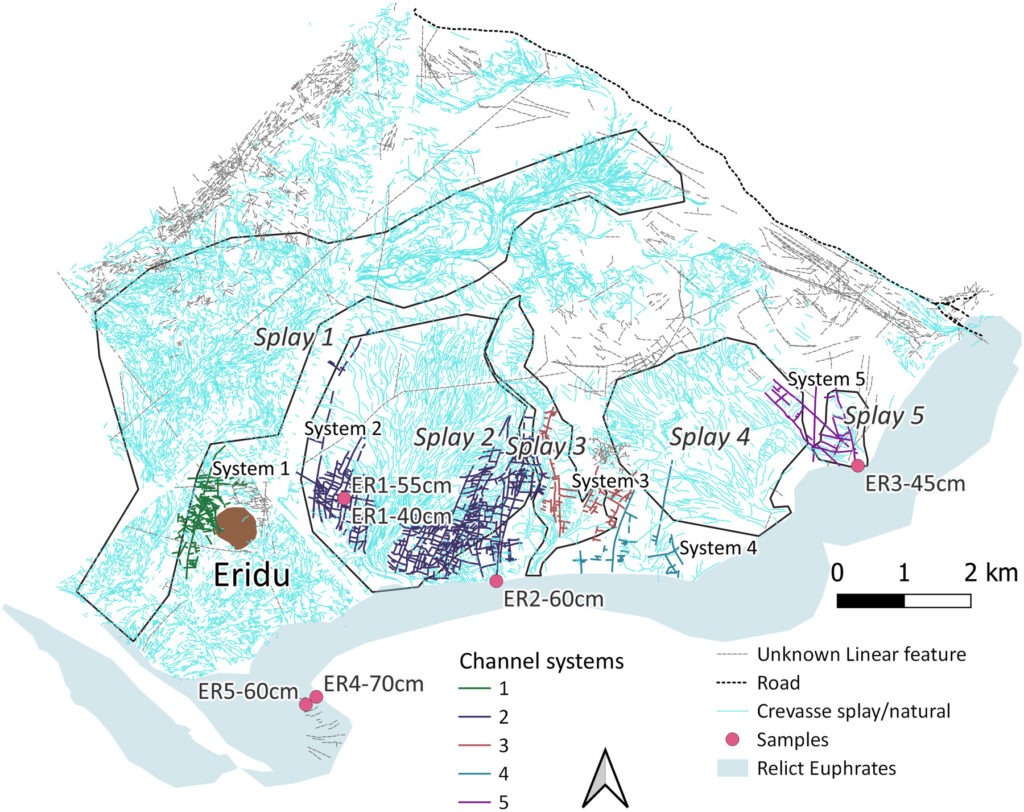
Fieldwork conducted in 2020 confirmed that the lines visible from space corresponded to surviving features in the landscape. Archaeologists excavated five small trenches across selected channels and the former bed of the Euphrates.
Freshwater shells recovered from the sediments were then analysed at the University of Oxford using accelerator mass spectrometry. The results placed different parts of the network between the fifth and second millennia BC, broadly corresponding with the long occupation of Eridu.
A Natural Watercourse Transformed by Farmers
The earliest date came from a location where an artificial-looking canal meets a natural crevasse splay formed when river water broke through its bank. Researchers suggest that farmers may have modified the existing watercourse before gradually incorporating it into a managed irrigation system.
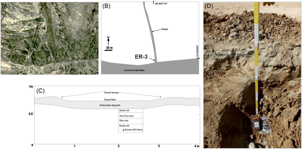
If this interpretation is correct, the feature preserves an important stage between exploiting naturally flooded ground and deliberately directing water toward cultivated fields. It dates to the Ubeyd period, when Eridu was developing into one of southern Mesopotamia’s earliest major centres.
Other sampled canals produced dates from the third millennium BC. By then, the network had become more extensive and regular, with channels dividing parts of the surrounding landscape into roughly rectangular plots.
This more orderly arrangement corresponds with cuneiform evidence describing the measurement, administration and division of agricultural land. It also suggests that water management grew increasingly organised as Mesopotamian settlements expanded.
The Farmland That Sustained Eridu
Founded during the sixth millennium BC, Eridu remained occupied for thousands of years and became one of Mesopotamia’s most important religious centres. Archaeologists have long studied its temples and mud-brick buildings, but the agricultural landscape that supported the settlement has received far less attention.
The newly dated canals indicate that at least some of the water-management features surrounding Eridu were active during its occupation. Together with the nearby marshes and river channels, this cultivated landscape would have formed part of a broader economy that included farming, livestock herding and fishing.
Researchers caution that the region’s water systems developed over thousands of years and cannot yet be reconstructed completely. Nevertheless, the study provides the first direct scientific dates for canals around Eridu and shows that local communities were modifying the Euphrates landscape approximately 6,500 years ago.
The systems were probably abandoned or replaced as the Euphrates shifted its course. What remains preserves evidence that Mesopotamia’s earliest centres depended not only on temples and rulers, but also on generations of farmers learning how to work with a constantly changing river.
Cover Image: An ancient irrigation channel recorded near Eridu during fieldwork in October 2020. Louise Rayne et al., Iraq, Cambridge University Press, CC BY 4.0.