
Archaeologists surveying shallow waters north of Rome have identified a submerged Etruscan harbor that may once have carried sailors directly to a coastal sanctuary.
The stone structure lies off Santa Marinella, about 90 meters from the modern shoreline and at an average depth of 1.5 meters. Its construction has been tentatively dated to between the late fourth and early third centuries BC.
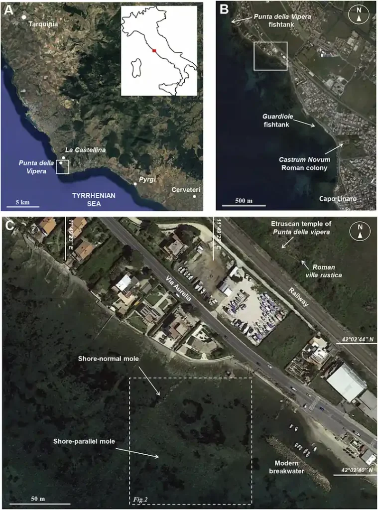
Located only 130 meters from the Temple of Punta della Vipera, the harbor may be the earliest known Etruscan landing place directly associated with a sanctuary.
The discovery is detailed in a new study published in the Journal of Cultural Heritage. The research was carried out by specialists from Sapienza University of Rome and institutions involved in the maritime archaeology of the Santa Marinella coast.
Stone blocks reveal a harbor beneath the sea
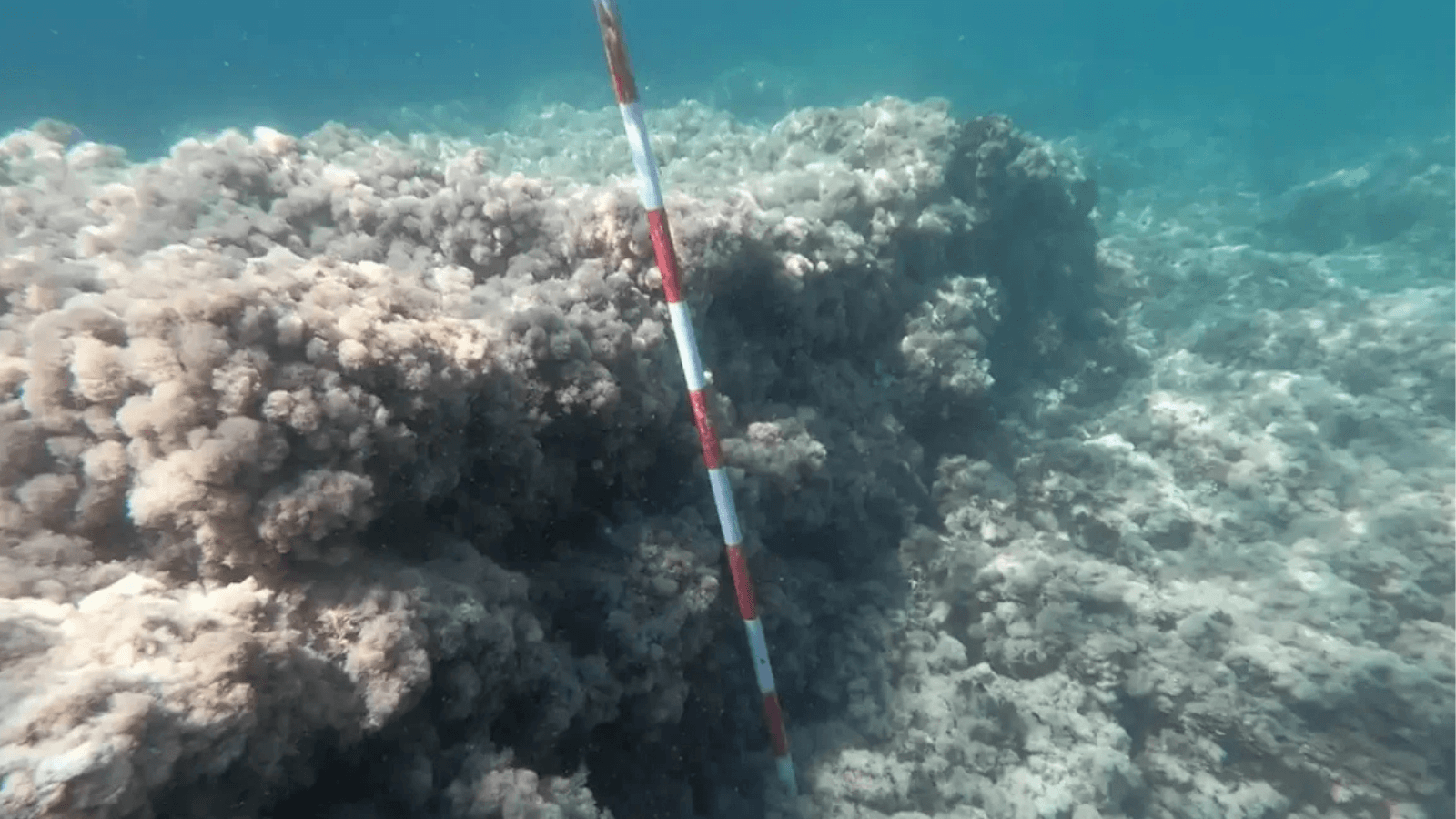
The site first appeared as two groups of worked calcarenite blocks scattered across the seabed. Drone photography and underwater measurements revealed that the stones belonged to a much larger structure.
One section ran parallel to the ancient shoreline before turning at a right angle. Together, the two arms formed an L-shaped harbor enclosing an area of almost 3,000 square meters.
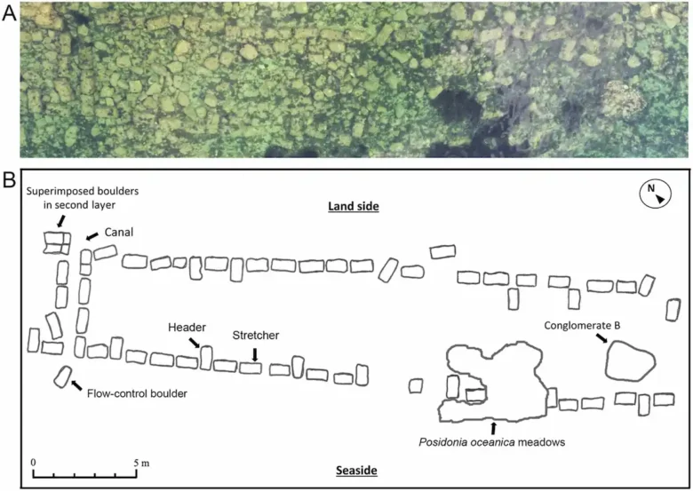
The better-preserved section consists of parallel rows of rectangular blocks with stones packed between them. This arrangement has been interpreted as the base of a mole—a substantial barrier designed to shelter boats from waves.
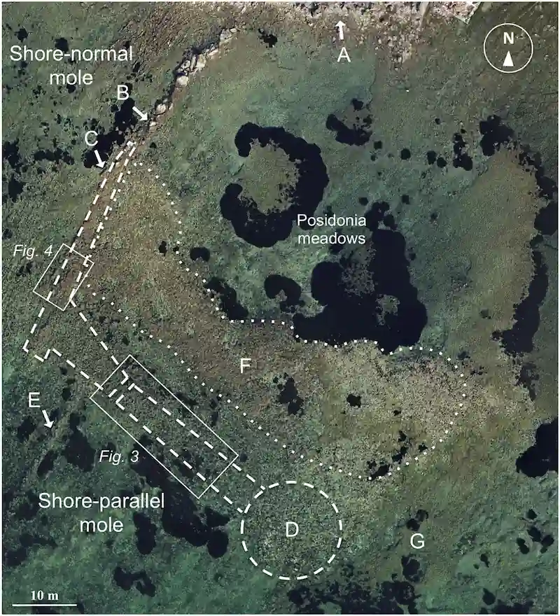
Much of the original stonework has disappeared. Some blocks were moved by the sea, while others were probably removed and reused in antiquity. The surviving remains nevertheless indicate that one arm extended approximately 35 to 40 meters from the shore and the other for more than 60 meters.
The enclosed basin would have provided enough space for vessels measuring between 15 and 20 meters to maneuver.
A narrow channel built through the mole may have allowed water to circulate between the harbor and the open sea. The feature could have helped prevent sediment from a nearby stream from gradually filling the basin.
A landing place beside an Etruscan sanctuary
The harbor lies close to the sanctuary of Punta della Vipera, founded around 540–530 BC and dedicated to Minerva, the Etruscan counterpart of the Greek goddess Athena.
Minerva was worshipped here for her healing and purifying powers. Excavations begun in the 1960s uncovered architectural terracottas, coins, anatomical votive offerings and a sacred well containing pottery and a lead plaque inscribed on both sides in Etruscan. Water and ritual offerings also appear together at the 2,500-year-old Etruscan sacred well recently excavated at Kainua.
The orientation of the sanctuary supports a maritime connection. Its entrance faced the sea rather than the inland settlement of Castellina del Marangone, less than two kilometers away.
People arriving by boat may therefore have landed at the newly identified harbor and followed a sacred route uphill to the temple, climbing approximately eight or nine meters from the shoreline.
Punic coins found in the sanctuary offer further evidence of overseas contact. Dating to the later fourth century BC, they point to trade with Carthage and suggest that vessels from outside the immediate region reached Punta della Vipera.
Ancient writers described the Etruscans as a major naval power in the western Mediterranean, yet physical evidence of their maritime infrastructure is scarce. Coastal erosion, rising sea levels and the reuse of building stone have destroyed or concealed many of their harbors.
Dating the submerged structure
No organic material suitable for radiocarbon dating has been recovered from the harbor. Its proposed age is instead based on the construction method, its relationship with the sanctuary and changes in the local sea level.
A surface interpreted as the original walkway of the mole is now submerged by approximately 50 to 60 centimeters. To function as a landing place, it would once have stood at least 70 to 80 centimeters above the water.
The measurements indicate that the sea was around 1.2 to 1.4 meters lower when the harbor was operating. When compared with reconstructions of ancient sea levels along the northern Lazio coast, this points to construction near the end of the fourth or beginning of the third century BC.
The absence of hydraulic concrete, which became a defining feature of later Roman maritime engineering, also makes a Roman date less likely.
This proposed chronology coincides with a major rebuilding of the nearby temple. The sanctuary appears to have been damaged during the fourth century BC, possibly amid military attacks along the Tyrrhenian coast, before being extensively reconstructed.
The harbor may have been built during this restoration. Another possibility is that an earlier natural landing place had served the sixth-century BC sanctuary before being enlarged with stone moles.
What happened to the harbor?
By the first century BC, the sanctuary had given way to a Roman agricultural villa. Several blocks incorporated into the villa resemble those on the seabed, suggesting that parts of the harbor were dismantled and reused.
Other stones may have been taken to build a Roman fish tank about 800 meters away. What survives underwater is largely the lowest course of blocks and the natural rock used as the foundation.
Fragments of red clay tile have also been observed inside the submerged basin. Some resemble material recovered from the temple, but no systematic excavation has yet tested what remains beneath the sediment.
That work could determine whether sailors approaching Punta della Vipera stepped ashore here before following the sanctuary’s sea-facing entrance uphill—a route that has been missing from the archaeological record for more than two millennia.