Roman Side is remembered for its theatre, temples, baths and monumental fountains. Yet the water that sustained this wealthy Mediterranean port began its journey far beyond the city, in the foothills of the Taurus Mountains.
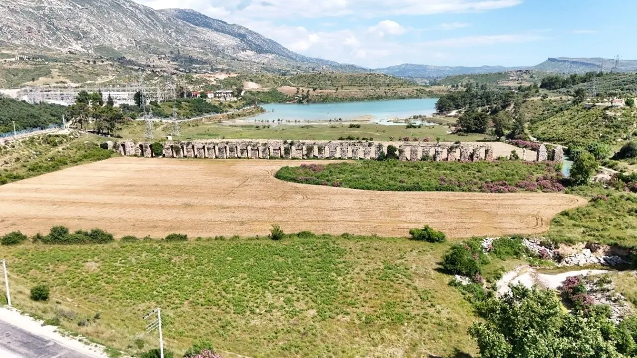
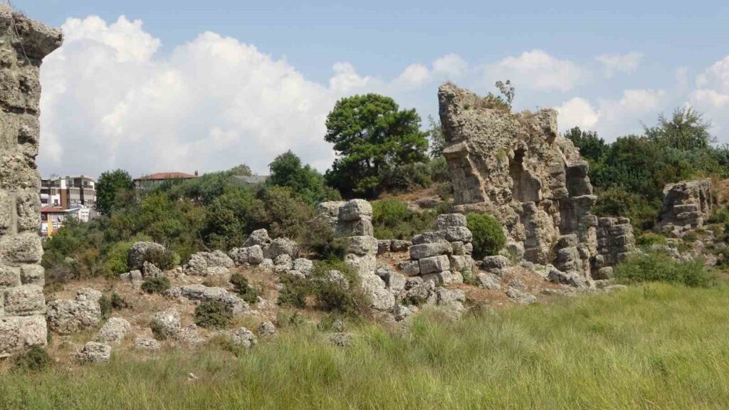
Near Oymapınar in Antalya’s Manavgat district, the damaged remains of that ancient supply network still cross the landscape. Recent photographs show broken arches, isolated supports and stone blocks scattered where sections of the structure have collapsed.
Historian and author Mahmut Öz has called for the surviving waterway to be documented and protected. He warned that without conservation, further parts of the system could disappear.
Side’s water came from the mountains
The aqueduct channelled water from the Dumanlı spring near Oymapınar towards Side on Türkiye’s southern coast. Its monumental remains are associated with the city’s growth during the Roman imperial period, particularly around the second century AD.
Side had already existed for centuries, but Roman rule brought a new scale of construction. Public baths, fountains and densely occupied neighbourhoods all depended on a dependable supply of fresh water.
The solution was a network rather than a single structure. Water travelled through channels cut into the landscape, tunnels driven through rocky ground and elevated sections built wherever the terrain dropped below the required level.
Öz said the route included around 40 arches. The surviving line near Oymapınar was therefore one element within a much longer system connecting an inland spring with the coastal city.
An engineering problem measured in centimetres
The most impressive part of an aqueduct was not necessarily its height or the number of its arches. Its success depended on maintaining a slight, carefully controlled descent over the entire route.
If the channel rose too much, the flow would stop. If it descended too sharply, the water could damage the masonry and sediment could accumulate in sections of the system.
Roman surveyors adapted the route to the natural contours of the land. They used tunnels where hills blocked the way and arches where valleys or depressions interrupted the necessary gradient.
By the time the water entered Side, it had travelled across a carefully engineered sequence of structures. It could then be distributed to buildings that shaped the city’s public and social life, particularly its bath complexes and fountains.
What remains is disappearing
The ruins near Manavgat make the scale of the system visible, but they also reveal how much has already been lost. Some arches survive as a continuous line, while elsewhere only disconnected piers and fallen stones remain.
Öz said tunnels along the route had been filled, ventilation openings damaged and parts of the waterway affected by later construction. His appeal for action had not received a publicly announced response from the relevant authorities when this article was prepared.
Preserving the aqueduct would begin with tracing what survives above and below ground. A detailed archaeological survey could establish which sections are most vulnerable and separate original Roman masonry from later alterations.
The immediate issue is not whether the aqueduct can be made to carry water again. It is whether enough of the structure can be stabilised to preserve the story it still tells: how Roman engineers brought a distant mountain spring into the daily life of one of Pamphylia’s busiest ports.
Cover Image: Only fragments remain in parts of the route, where fallen blocks surround the broken supports of Side’s Roman water network. Credit: İHA