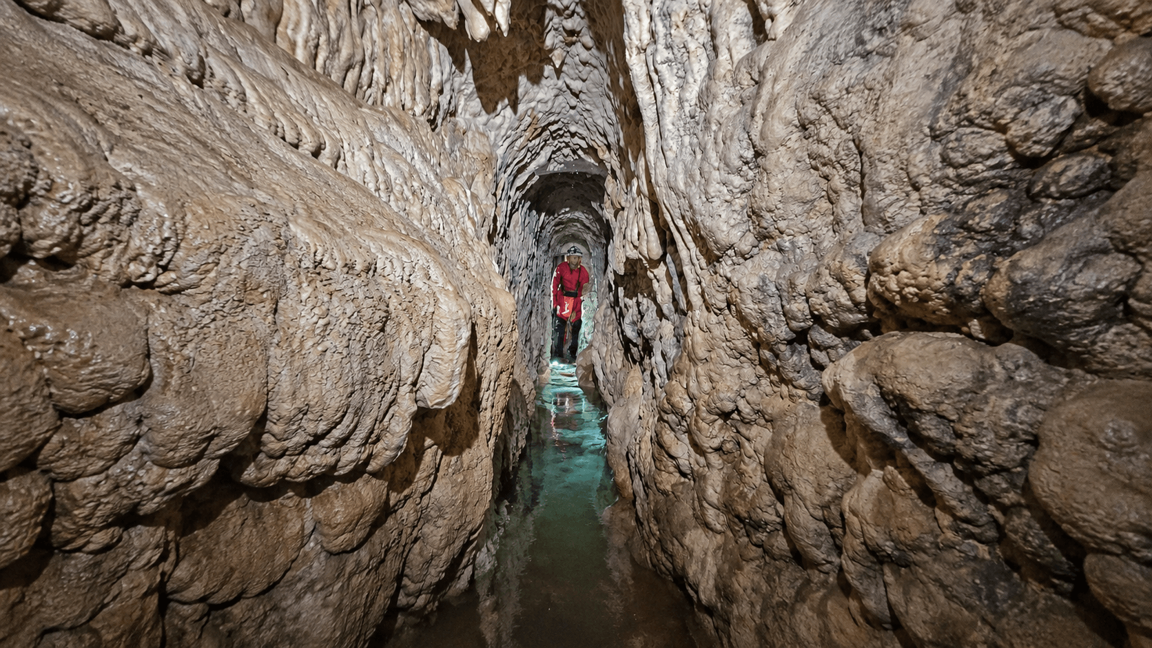
Long before Rome absorbed the Sabine territories of central Italy, communities in the hills northeast of the city were already reshaping the landscape to control water. Archaeologists have now documented a rock-cut aqueduct near the ancient settlement of Trebula Mutuesca, revealing sophisticated engineering from the region’s pre-Roman past.
The underground structure was discovered at Monteleone Sabino in the province of Rieti, about 50 kilometers northeast of Rome. According to Italy’s Superintendency for Archaeology, Fine Arts and Landscape for the Metropolitan Area of Rome and the Province of Rieti, approximately 100 meters of the aqueduct can currently be inspected.
The investigation was carried out by the Gruppo Speleo Archeologico Vespertilio under the scientific direction of the Superintendency, in collaboration with the Municipality of Monteleone Sabino. Combining archaeological research with speleological exploration allowed the team to examine a structure concealed beneath a landscape long associated with the ancient Sabines.
An Aqueduct Cut Directly into the Hill
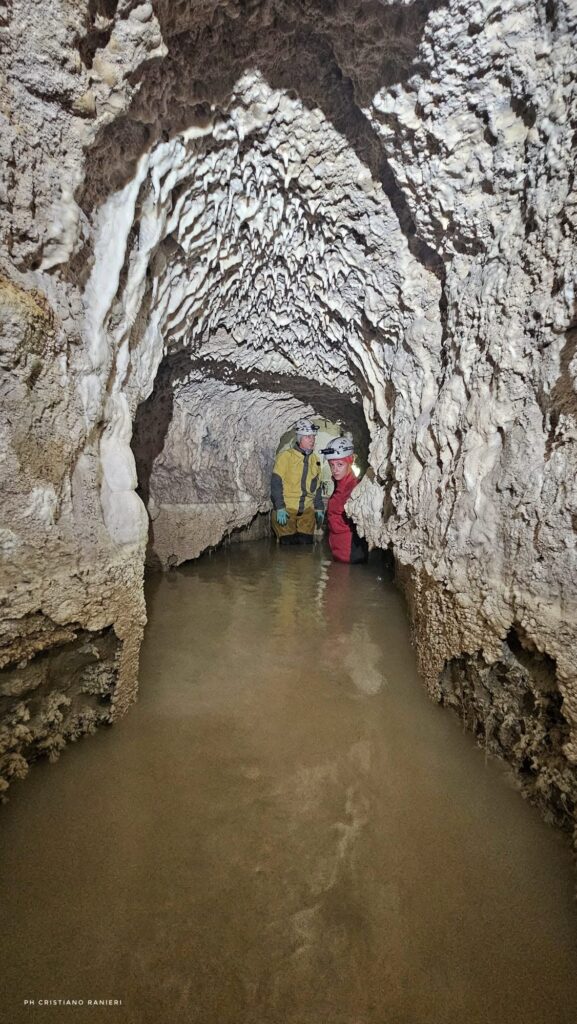
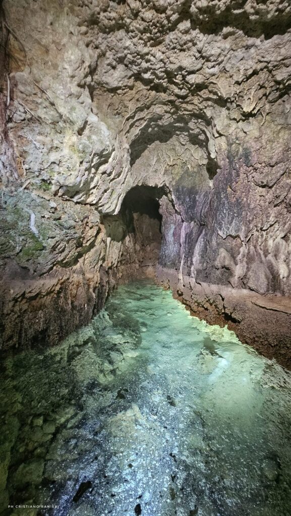
Unlike the monumental Roman aqueducts carried across valleys on arches, the newly documented system runs underground and was carved entirely through rock. Its passage has a distinctive ogival, or pointed-arch, cross-section.
The construction method offers important evidence of how its builders approached the excavation. Workers first opened transverse access tunnels at regular intervals and then continued digging parallel sections along the line of the ridge.
Completing such a project would have required careful planning, technical knowledge, organized labor and considerable resources. Researchers believe the scale and complexity of the work indicate coordination by an established central authority.
The aqueduct appears to have served primarily agricultural purposes. It may have drained excess water, regulated flows across the landscape and improved the productivity of cultivated soils rather than simply supplying drinking water to a settlement.
What the Aqueduct Reveals About the Sabines
The discovery provides new evidence for how the territory around Trebula Mutuesca was organized before Romanization. The area developed around a pagus, a rural district composed of smaller settlements known as vici, linked by a strategic route between the Apennine interior and the Tiber Valley.
Controlling water across this landscape would have required cooperation among these communities. According to the Superintendency, the investment and technical expertise behind the aqueduct point to a stable and structured population with the resources needed to carry out complex public works.
The underground channel therefore offers more than an example of early hydraulic engineering. It shows that the Sabines were actively planning agricultural landscapes and managing water on a territorial scale before the region was incorporated into the Roman world.
Researchers have not yet announced a precise construction date for the aqueduct. Preliminary findings were presented at the 15th Conference on Lazio and Sabina Studies in 2026, while continued research may clarify its chronology, full route and relationship with the settlements of the pagus of Trebula Mutuesca.
Cover Image: A researcher explores the rock-cut passage of the pre-Roman Sabine aqueduct at Monteleone Sabino in central Italy. Credit: Cristiano Ranieri