
The Bronze Age Mycenaean road network across the Peloponnese reveals a sophisticated system of travel and trade in ancient Greece.
Researchers have harnessed cutting‑edge digital tools to trace how travellers moved across ancient Greece, offering the clearest reconstruction yet of the road network built by the Mycenaeans in the Late Bronze Age. The new study, led by Christopher Nuttall and published in the Journal of Archaeological Science, compares hundreds of computer‑simulated routes against surviving Bronze‑Age road segments across the Peloponnese. The goal: measure how closely the virtual routes align with ancient paths carved into the landscape over 3,000 years ago.
Digital modelling sheds new light on ancient Greek routes
The research relies on a technique called “least‑cost path” analysis: a method that models movement across terrain by assigning a “cost” to travel — for example, the extra energy required to climb a slope — so the algorithm identifies the route requiring the least physical effort. A path with fewer steep inclines, fewer obstacles and gentler terrain therefore represents a lower cost and becomes a likely route for ancient travellers.
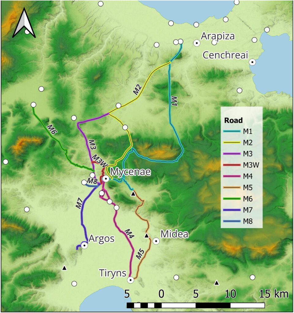
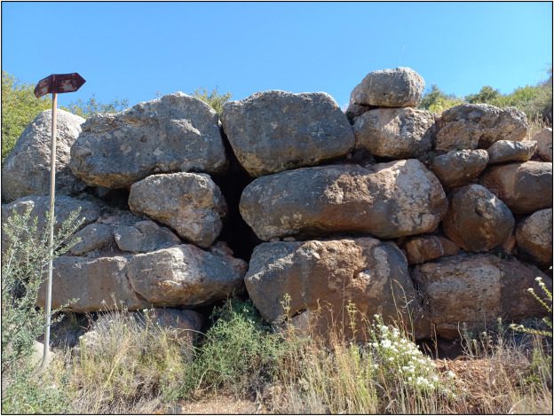
Nuttall’s team applied this technique to three documented segments of Mycenaean roads: a route in Messenia (south‑western Peloponnese), the well‑preserved Tiryns–Epidauros road, and the so‑called “M1” road leading northeast from the major centre of Mycenae. These road stretches still feature engineering traces such as stone paving, drainage systems and massive block bridges — making them ideal test cases.
Testing different movement‑models to match real remains
The researchers ran multiple simulations, testing five movement functions that model different types of travel: walking, energy expenditure (metabolic cost), and wheeled transport (carts or wagons). They also varied parameters such as slope sensitivity, movement direction (4‑, 8‑ or 16‑directions), and a “cognitive slope” factor — which accounts for how humans perceive steepness (i.e., we tend to avoid slopes that feel steep).
The modelling used two widely‑available digital elevation datasets: NASA’s SRTM‑DEM, and the European Copernicus DEM (at ~30 m resolution). Using both datasets, the team ran hundreds of virtual routes for each road segment and then compared those results to the actual archaeological remains.
Across most of the cases, the strongest match came from the “wheeled‑vehicle critical slope cost” function. This model is specially tailored to simulate the limits of carts or wagons: it factors in a “critical slope” beyond which wheeled transport becomes inefficient, forcing the route to curve, zigzag or avoid steep gradients. In the Messenia route and the Berbati Valley segment, the model designed for wheeled traffic corresponded most closely with the known Mycenaean road remains.
One notable exception was the Tiryns–Epidauros road: there, walking‑based functions (i.e., pedestrian models) produced the best match. This may indicate that the route originally functioned as a footpath and was later upgraded to a formal road. The finding also supports the view that this road likely originated at the ancient port of Nauplio rather than directly at Tiryns — thereby linking two maritime zones (the Argolic and the Saronic gulfs).
Ancient roads reveal their purpose across the Peloponnese
The digital results bolster long‑held theories about Mycenaean patterns of movement and infrastructure. For example:
The Messenia route appears to have connected coastal zones on the Bay of Navarino and the Messinian Gulf, offering a land shortcut that avoided the long sea‑voyage around the southern Peloponnese coast.
The Tiryns–Epidauros road in the Argolid likely served to ease movement of goods between the Argolic Gulf and the Saronic Gulf — thereby linking maritime trade zones.
The M1 road remains more ambiguous. The model did not clearly support a direct route to Corinth, as previously assumed. Instead, the simulations point toward other possible destinations: the port of Kalamianos or the upland area around Ayios Vasileios (a site with ritual potential).
Uncertain endpoints show limits of current modelling
The researchers stress that these digital reconstructions are not exact replicas of past reality. The models are highly sensitive to underlying input data: small variations in slope, elevation or grid resolution can change the predicted path. Nuttall emphasises that least‑cost models need careful calibration and must always be cross‑checked against real archaeological evidence.
For instance, the ambiguity around the M1 road’s destination underlines how even good models can have limits when endpoints or environmental conditions are uncertain. In such cases, archaeological fieldwork remains indispensable.
Study sets new benchmark for reconstructing ancient roads
In sum, the findings reinforce the idea that Mycenaean roads formed part of a coordinated transport system linking palaces, ports and regional centres across the Peloponnese. These roads facilitated trade, communication and political control in the Late Bronze Age world of mainland Greece.
Importantly, the study demonstrates that modern digital tools (GIS + R + least‑cost modelling) can reveal how early engineers planned and used their routes — but only when combined with rigorous testing and physical archaeology. As higher‑resolution terrain and elevation data become available, researchers expect to produce even more accurate reconstructions of the ancient transport networks that shaped Bronze‑Age Greece.
What this means for Bronze‑Age archaeology
Beyond cartographic novelty, this research has broader implications:
Infrastructure & Economy: The fact that wheeled‑traffic models fit many of the routes suggests that the Mycenaeans did not solely rely on foot‑paths or animal‑trackways. They engineered roads capable of supporting carts—implying substantial movement of goods, agricultural produce or possibly military equipment.
Landscape & Engineering: Building efficient roads through mountainous terrain required planning: avoiding steep slopes, bridging streams, paving surfaces, managing drainage. These were not incidental tracks, but deliberate infrastructural investments.
Methods & Scope: The methodological advance — coupling GIS with the R ‘Movecost’ package, testing multiple cost‑functions and DEMs — sets a new standard for archaeological landscape analysis. Other regions and time‑periods can adopt a similar framework.
Regional Connectivity: Recognising that these roads linked major maritime zones reinforces the view that Bronze‑Age Greece was a highly networked realm — not isolated polities but integrated systems of movement, trade and power projection.
Looking ahead
While the study focuses on three well‑preserved road segments, there is enormous scope for expanding the approach: mapping lesser‑known routes, integrating archaeological settlement data, linking inland centres with coastal hubs, and exploring seasonal or ritual routes.
As digital elevation models improve (higher spatial resolution, better ground‑truthing) and as archaeological surveys continue to document road‑remains in the field, we can expect even more detailed reconstructions — perhaps a full network map of Mycenaean Greece. For now, this study stands as a milestone in understanding how Bronze‑Age engineers shaped movement across rugged terrain, at a time when Greece was forging one of its earliest complex polities.
Nuttall, C., & Kovačević, J. (2025). Reconstructing Mycenaean road networks using digital least-cost path analysis. Journal of Archaeological Science, 160, 105890. https://doi.org/10.1016/j.jas.2025.105890