A rare Neanderthal handaxe, Roman industrial remains and large Anglo-Saxon cemeteries may appear to belong to entirely different archaeological stories. Yet all of them have emerged from the same landscape in Suffolk, where Sizewell C archaeology is revealing evidence of human activity stretching back more than 36,000 years.
Oxford Cotswold Archaeology (OCA) has now launched a new interactive map showing where some of the most remarkable discoveries connected with the Sizewell C nuclear power project were made. The map allows users to move across the landscape and explore individual excavation areas, from Palaeolithic finds to Roman industry and early medieval burial grounds.
According to Suffolk County Council, around 200 OCA archaeologists were working across 70 sites covering roughly two million square metres at Sizewell C in early 2026. Together, the excavations are exposing a remarkably long sequence of human activity, including prehistoric settlement, Roman production sites, Anglo-Saxon cemeteries, medieval remains and Second World War coastal defences.
A Neanderthal tool up to 59,000 years old

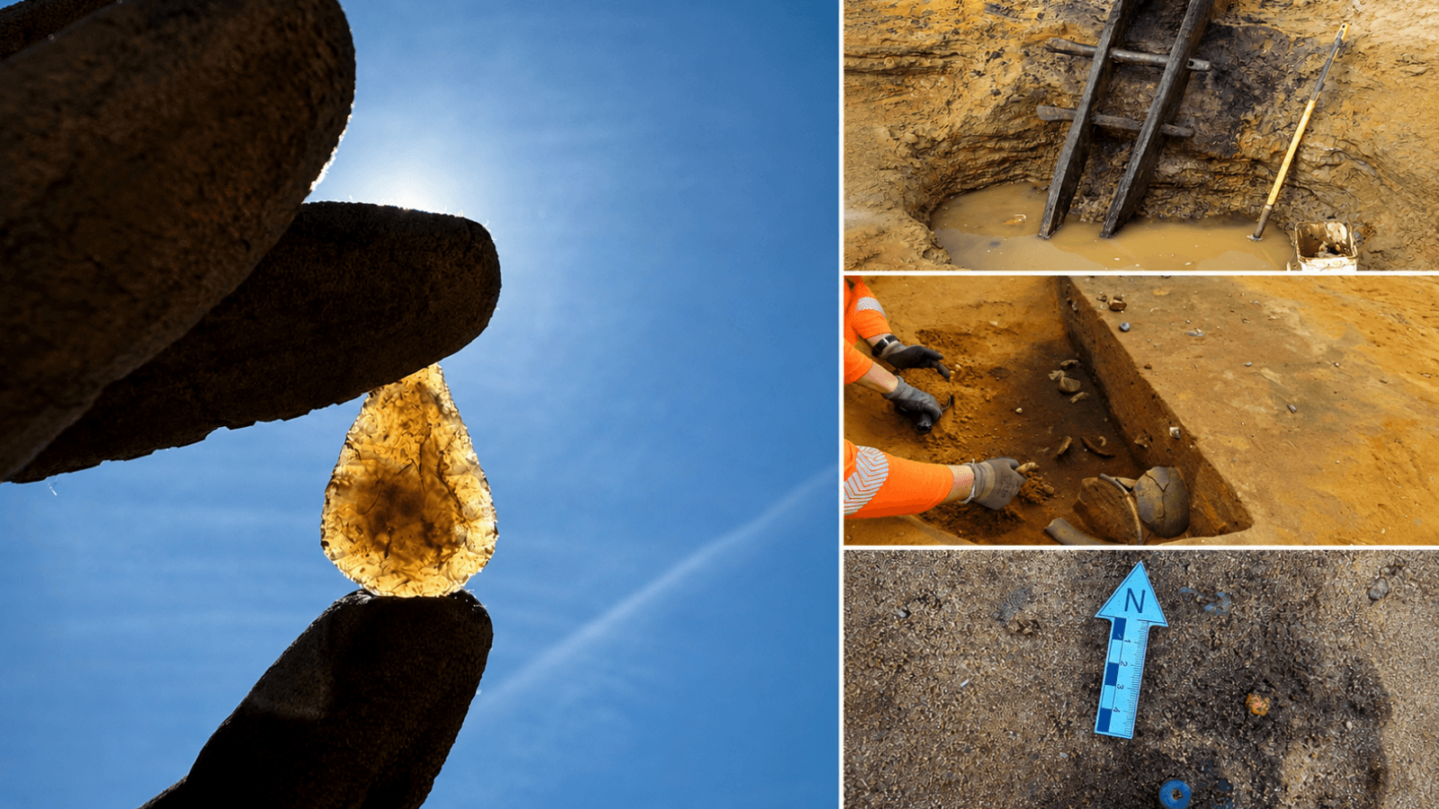
Among the oldest discoveries is a bout coupé handaxe dating to between approximately 36,000 and 59,000 years ago. Fewer than 100 examples of this distinctive type of stone tool have been recorded in Britain.
The palm-sized flint artifact measures about 11 centimetres high and weighs just 166 grams. Despite its name, such a tool could have served several purposes, potentially including butchering animals, cutting plant fibres, chopping wood and digging.
Its discovery was also unusual. Worker Colin Cooley spotted the handaxe in natural geological deposits rather than inside an archaeological feature such as a pit or settlement layer. Movement within the deposits over thousands of years had erased microscopic evidence that might have revealed precisely how the tool was used, but its deep position protected it from later agricultural ploughing.
Roman industry beneath the Suffolk landscape
Thousands of years later, parts of the same landscape became centres of organised production.
Near Middleton, archaeologists uncovered an exceptionally well-preserved Roman pottery kiln. The horizontal-draught structure used two flues to control airflow and distribute heat, while one of those flues survived intact together with sections of its internal lining.
Although no complete vessels remained inside the kiln, archaeologists recovered pottery fragments and material apparently discarded into the structure after it had fallen out of use. Nearby, the team also identified an unusual maze-shaped corn dryer, suggesting that agricultural processing accompanied pottery production in the Roman-period landscape.
At Goose Hill, close to the coast, excavations revealed evidence for another Roman industry: salt production. Brackish water was collected in clay-lined settling pits before being heated in rows of large ceramic evaporation pans, allowing salt to be extracted from the coastal water.
The same area preserves evidence from several other periods, ranging from Bronze Age activity to medieval remains and Second World War defensive structures.
More than 140 Anglo-Saxon graves at Middleton
Some of the most striking discoveries on the new map belong to the 7th century.
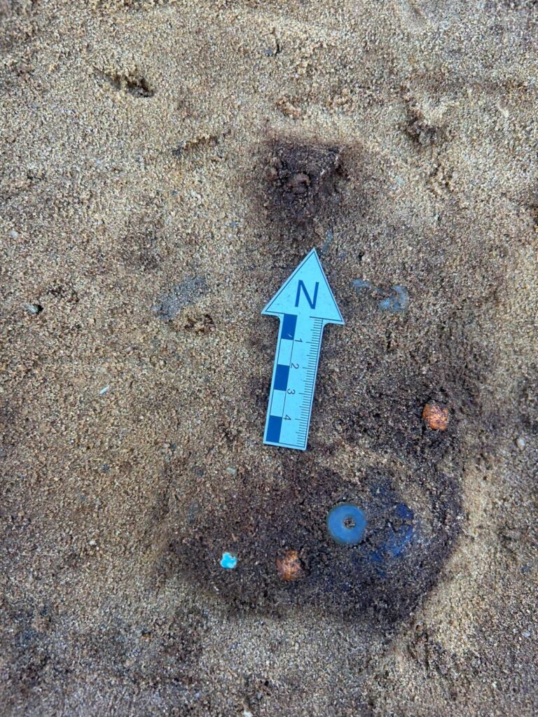
Near Middleton, archaeologists excavated a cemetery containing more than 140 graves. Finds included iron spears and blades, buckles and beads, while many of the graves followed an east-west alignment and appear to have been positioned carefully to avoid disturbing earlier burials.
The cemetery provides an unusually large archaeological sample from an early Anglo-Saxon community, offering valuable evidence for the study of burial customs, social organisation and community connections in early medieval Suffolk.
Yet another cemetery only a short distance away presents a dramatically different picture.
A ‘princely’ burial with a complete horse
Near Theberton, archaeologists uncovered an Anglo-Saxon cemetery occupying a prominent position in the landscape. The site contained 12 burial mounds, along with cremations and inhumation burials.
One grave was particularly remarkable. Two individuals had been buried beside a complete horse equipped with bridle fittings and decorated harness equipment.
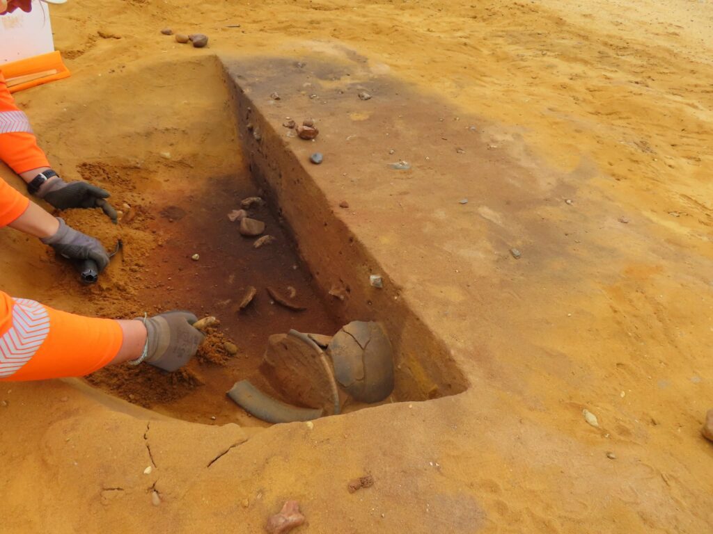
Weapons and other grave goods accompanied the dead, including shield bosses, a spear, swords, a metal bowl and a cup. The elaborate character of the burial led archaeologists to describe it as high-status or “princely,” placing it within the broader elite funerary tradition known from major East Anglian sites such as Sutton Hoo and Snape.
Archaeologists also identified nearby post-built structures and a sunken-featured building, while loom weights provide evidence that weaving took place close to the cemetery. Together, the remains offer researchers the unusual opportunity to investigate both where an Anglo-Saxon community lived and how some of its members were buried.
One landscape, tens of thousands of years
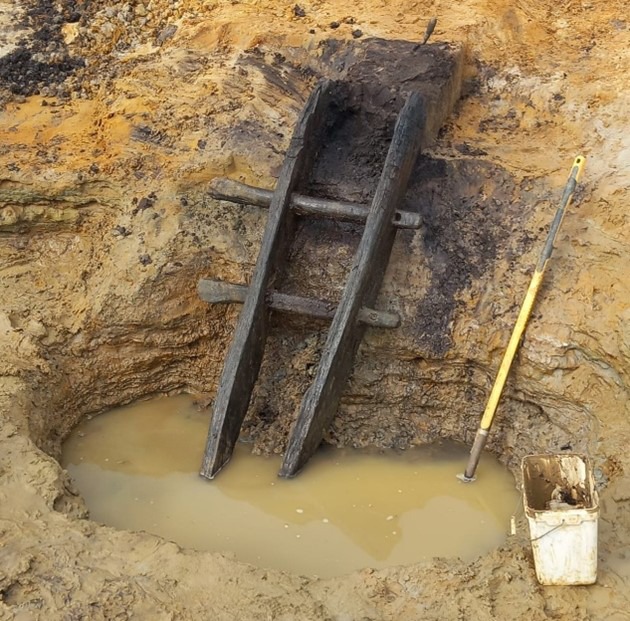
The Sizewell C excavations have produced other major discoveries, including an Iron Age oak ladder, Bronze Age remains and a hoard of more than 300 silver coins dating to the 11th century.
Seen together, the discoveries place a Neanderthal stone tool, Roman industrial installations and elaborate Anglo-Saxon burials within a single archaeological landscape repeatedly occupied and reshaped over tens of thousands of years.