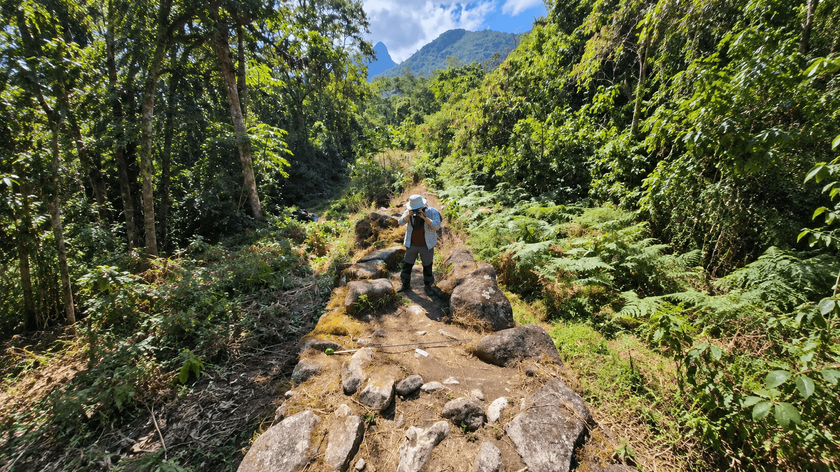
More than 2.5 kilometers of previously undocumented roads have emerged from beneath the rainforest surrounding Machu Picchu, revealing human activity in an area long overshadowed by the famous Inca citadel.
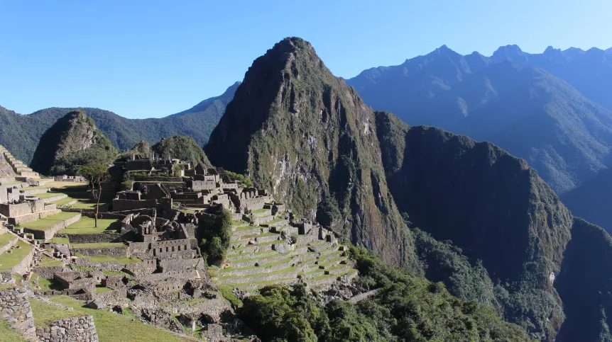
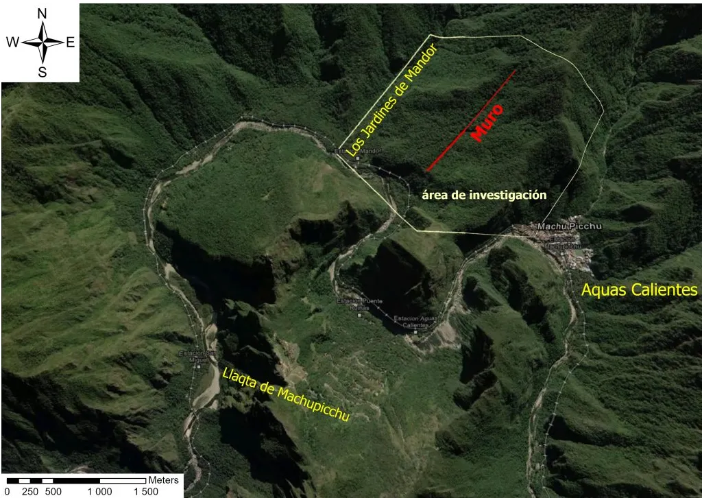
The roads were identified on the slopes of Yanantin Mountain, across the Urubamba River from the main archaeological complex. Drone-mounted LiDAR also detected unknown terraces, platforms and circular structures hidden beneath the vegetation.
For archaeologists, the location may be as significant as the length of the roads. Most known satellite sites associated with Machu Picchu lie on the opposite side of the river, but the new evidence suggests that the wider landscape was developed far more extensively than previously understood.
Roads hidden beneath the rainforest
The surveyed area lies between approximately 2,000 and 2,700 meters above sea level on the eastern slopes of the Andes. Its steep terrain is covered by humid tropical forest so dense that walls, roads and artificial terraces can remain invisible even at close range.
Fieldwork illustrates the scale of the challenge. According to Professor Mariusz Ziółkowski, director of the University of Warsaw’s Centre for Andean Studies, researcher Bartłomiej Ćmielewski needed around three hours to cover only 250 meters while cutting through the vegetation with a machete.
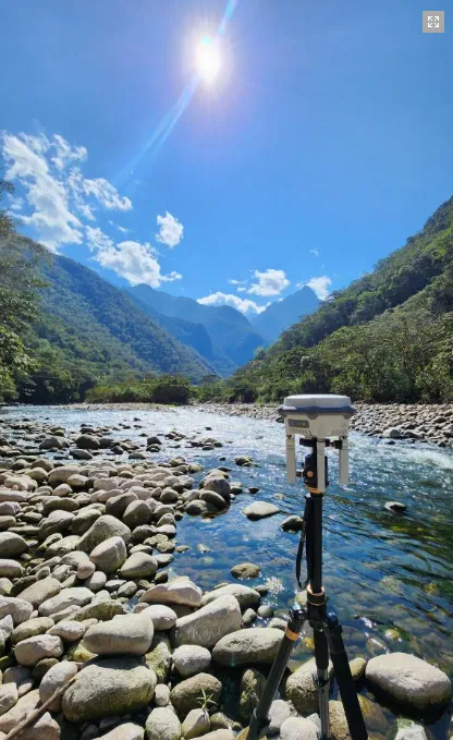
The team therefore used a LiDAR scanner carried by a drone. Laser pulses passing through gaps in the canopy allowed researchers to create a three-dimensional model of the ground and digitally remove much of the vegetation.
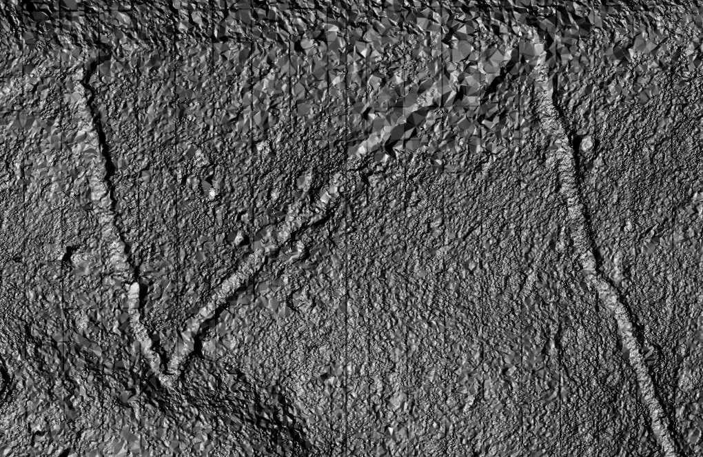
Narrow zigzagging routes and regular geometric features then appeared in the data. One path, less than a meter wide, was already known to local residents, but further drone flights revealed a much larger network extending through the forest.
Initial analysis documented more than 2.5 kilometers of pre-Columbian roads. The longest clearly visible section runs for at least 1.2 kilometers, while additional routes may emerge as specialists continue processing the survey data.
Ziółkowski expects the recorded total to at least double. LiDAR analysis is labor-intensive, and the material collected during the July and August 2026 field season has only begun to be examined in detail.
Were the roads built by the Inca?
The zigzagging courses and the way the roads negotiate the mountain slopes resemble methods used by Inca engineers. Their precise age, however, has not yet been established.
Some routes may have originated before the rise of the Inca Empire and later been rebuilt or incorporated into its transportation system. Targeted excavations will be needed to study their construction and recover material that could help establish when they were used.
The nearby terraces, platforms and circular structures suggest that the roads did more than carry travelers through the mountains. They may have connected settlements, cultivated land, ceremonial locations or other specialized sites around Machu Picchu.
More than 60 archaeological sites are already known within the Machu Picchu National Archaeological Park. Many are linked by roads and are believed to have served different functions in relation to the principal settlement, known as Llaqta de Machu Picchu.
A new view of the Machu Picchu landscape
Most documented sites are concentrated on the left bank of the Urubamba River. This pattern had led researchers to believe that Inca construction and landscape engineering were focused largely on that side of the valley.
The discoveries on Yanantin Mountain challenge that view. They indicate that the Mandor area, directly across from Machu Picchu, was also substantially modified and integrated into the surrounding network.
Mapping these connections could reveal how people approached Machu Picchu, moved between its satellite communities and used different parts of the mountainous terrain. It may also explain how areas beyond the central settlement supported the larger complex.
The project brings together researchers from the University of Warsaw’s Centre for Andean Studies, Wrocław University of Science and Technology, Wrocław University of Environmental and Life Sciences, Peru’s Apu Space and the Regional Directorate of Culture in Cusco. The 2026 survey was funded by the University of Warsaw and carried out under Peruvian archaeological supervision.
Researchers are now discussing a longer-term program with representatives of Peru’s Ministry of Culture in Cusco. The next phase could expand the LiDAR survey and include limited excavations along selected sections of the roads.
The exact locations have not been disclosed to protect the remains from unauthorized searches and possible damage. More than a century after Machu Picchu became known worldwide, its surrounding forest is still reshaping the archaeological map of the region.
Map showing the research area in Mandor, across the Urubamba River from Llaqta de Machu Picchu. Graphic: Bartłomiej Ćmielewski
Mapping these connections could reveal how people approached Machu Picchu, moved between its satellite communities and used different parts of the mountainous terrain. It may also explain how areas beyond the central settlement supported the larger complex.
The project brings together researchers from the University of Warsaw’s Centre for Andean Studies, Wrocław University of Science and Technology, Wrocław University of Environmental and Life Sciences, Peru’s Apu Space and the Regional Directorate of Culture in Cusco. The 2026 survey was funded by the University of Warsaw and carried out under Peruvian archaeological supervision.
Researchers are now discussing a longer-term program with representatives of Peru’s Ministry of Culture in Cusco. The next phase could expand the LiDAR survey and include limited excavations along selected sections of the roads.
The exact locations have not been disclosed to protect the remains from unauthorized searches and possible damage. More than a century after Machu Picchu became known worldwide, its surrounding forest is still reshaping the archaeological map of the region.
Cover Image: A newly documented pre-Columbian road running through dense vegetation on the slopes opposite Machu Picchu. Credit: Jeff Contreras