
For more than a century, the exact location of Medina Alzahira, the vanished seat of power built by Almanzor at the height of Umayyad rule in al-Andalus, has remained one of medieval Iberia’s most persistent archaeological riddles. Dozens of hypotheses were proposed. None could be anchored to verifiable physical evidence.
That may now have changed.
A new study led by Antonio Monterroso Checa of the University of Córdoba argues that high-resolution LiDAR data has finally revealed the physical footprint of the lost city. Published in Meridies. Estudios de Historia y Patrimonio de la Edad Media, the research builds on Monterroso Checa’s earlier work and significantly expands the scale of the proposed site.
Reading a City Hidden in the Terrain
The breakthrough comes from the analysis of digital elevation models generated from Spain’s latest open-access LiDAR survey, released by the Instituto Geográfico Nacional. With far greater resolution than datasets available even a few years ago, the new coverage allows subtle variations in terrain to be read with unprecedented clarity.
In an area historically known as Cabezos de las Pendolillas, near Alcolea and roughly twelve kilometers east of Córdoba’s Great Mosque, the LiDAR scans reveal a continuous chain of anomalies stretching for more than 1.2 kilometers. These are not random irregularities. According to the study, they reflect buried and partially preserved architectural remains forming an extensive archaeological complex.
The pattern that emerges is unmistakably urban. Rectangular and quadrangular structures appear arranged in a terraced layout, forming an organized grid that covers approximately 120 hectares. In scale, this matches almost exactly that of Medina Azahara, the famous caliphal city abandoned by Almanzor when he consolidated his own authority.
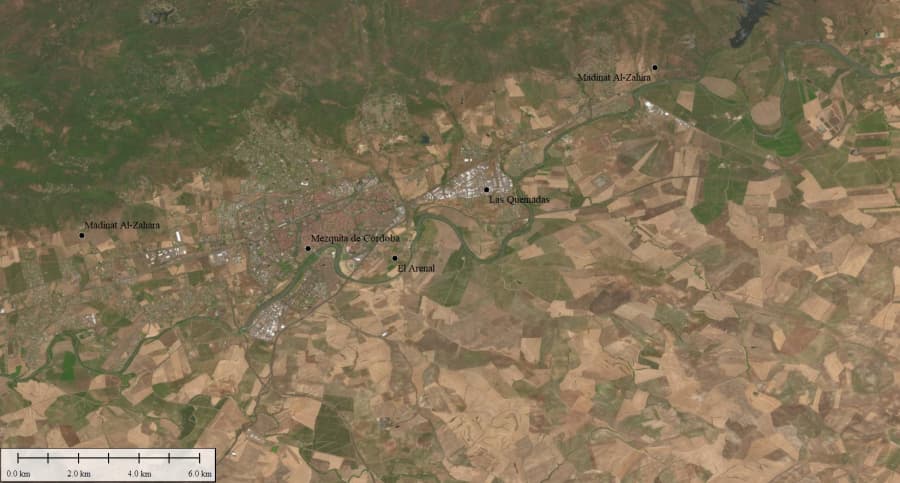
Credit: A. Monterroso / University of Córdoba
A Deliberate Rival to the Caliph’s City
This near-identical size is not treated as coincidence. Medina Alzahira, founded between 979 and 987, was conceived as a political counterweight to Medina Azahara—a physical manifestation of Almanzor’s dominance as hajib to the caliph Hisham II. Its very name, meaning “the resplendent city,” signaled ambition.
The LiDAR data also reveal deviations from strict orthogonality. In several areas, structures break alignment to orient southeast, suggesting careful adaptation to topography rather than a purely schematic plan. This complexity reinforces the interpretation of a consciously designed administrative capital rather than a temporary encampment or satellite settlement.
Power, Land, and Long Memory
Historical land use strengthens the case. From the fifteenth century onward, the area is documented as royal pastureland tied directly to the Crown and later housed the Royal Stud Farms under Philip II. Alongside the surroundings of Medina Azahara, it is one of only two recorded Dehesas Reales within Córdoba’s territory—an unusual continuity of elite control that the study integrates into its broader interpretation.
Rather than proposing a radically new location, Monterroso Checa’s work gives measurable substance to a hypothesis long favored by historians. Earlier scholars, most notably Leopoldo Torres Balbás, argued—based on medieval sources such as al-Maqqari—that Alzahira lay east of Córdoba, near a bend in the Guadalquivir. LiDAR now translates that textual intuition into a tangible geomorphological signature.
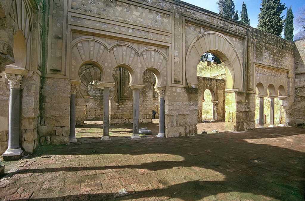
Credit: Sombradeparra / Public domain / Wikimedia Commons
From Laser Pulses to Excavation
The implications reach beyond a single city. The same methodology, developed within the Unidad Patricia research group, has already led to the identification of hundreds of previously unknown archaeological sites across Córdoba province, underscoring the transformative impact of open-access LiDAR on landscape archaeology.
For Medina Alzahira, however, aerial detection is only the beginning. The study stresses that confirmation will require high-resolution geophysical surveys on the ground, capable of mapping subsurface structures in detail. Excavation, if approved, would follow.
If verified, the discovery would mark the recovery of one of the most symbolically charged cities of medieval Iberia—a metropolis that rose rapidly with Almanzor’s power and was obliterated just as decisively in 1009, when Córdoba’s population destroyed it in a deliberate act of political erasure.
For more than a thousand years, Alzahira survived only in texts. Now, its outline may finally be emerging from the soil.
University of Córdoba
Monterroso Checa, A. (2026). Proposed Location of Madinat Al-Zāhira at the Eastern Edge of Córdoba. Meridies, Vols. 15–16 (2024–2025), pp. 98–139. University of Córdoba Journals.