
In the eastern outskirts of Rome, archaeologists have brought to light a remarkably layered archaeological landscape—one that traces daily life, belief, and burial practices across more than 700 years. Excavations at Acacia Park 2, near Via di Pietralata, reveal a suburban zone shaped by roads, rituals, and families from the early Republic through the dawn of the Imperial age.
The work, led by Rome’s Special Superintendence under the Italian Ministry of Culture, is part of a large-scale urban archaeology program spanning roughly four hectares. Since 2022, each excavation season has added depth to a site that quietly preserves funerary monuments, cult architecture, hydraulic features, and a road network dating from the 5th century B.C. to the 1st century A.D.
A Republican Road That Structured the Landscape
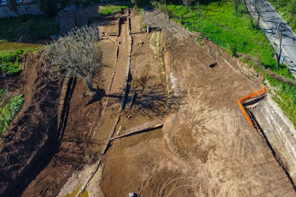
Running through the heart of the site is an ancient road axis that once followed a watercourse feeding into the Aniene River. Archaeologists believe the route formalized an even older path, but its first clearly defined phase belongs to the mid-Republican period, around the 3rd century B.C.
Two construction techniques mark the road’s evolution. One section consisted of compacted earth, aligned with today’s Via di Pietralata. Another was carved directly into the tufa bedrock near Via Feronia. In the 1st century A.D., the route was upgraded with a new surface and flanked by opus reticulatum masonry, signaling a more monumental phase. Deep carriage ruts still visible in the stone preserve rare, physical traces of ancient traffic.
By the 2nd and 3rd centuries A.D., however, the road’s role had changed. Pit burials cut into its margins suggest the route had fallen out of use, gradually absorbed into a funerary landscape as urban priorities shifted.
A Small Sanctuary, a Powerful God
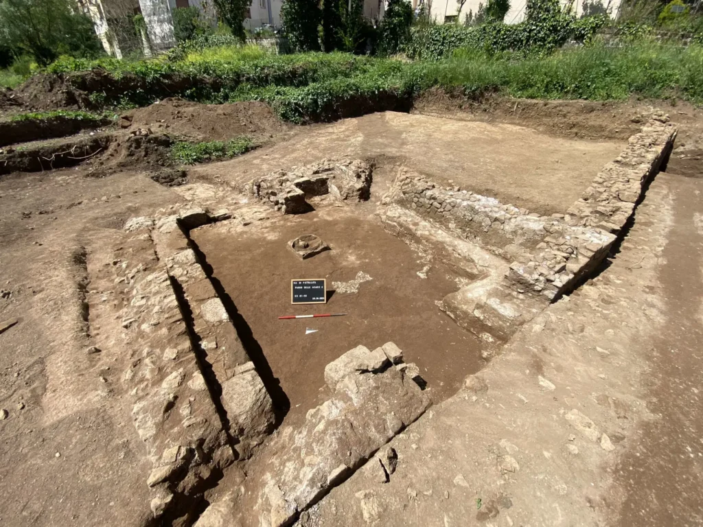
At the road’s end, excavators uncovered a compact cult building—a sacellum measuring roughly 4.5 by 5.5 meters—constructed from tufa blocks and finished with plastered walls. Inside, a central altar base and a wall niche point to the presence of a cult statue.
Beneath the structure lay a dense votive deposit: terracotta figurines, anatomical offerings, and animal representations. Together, they strongly indicate a dedication to Hercules, a deity closely associated with travel routes and boundary zones. The identification aligns with Hercules’ widespread worship along the Via Tiburtina, which linked Rome to Tibur (modern Tivoli).
Bronze coins recovered from the deposit date the sanctuary to the late 3rd or 2nd century B.C., firmly placing it within the Republican era.

Monumental Tombs and Traces of Ancient Medicine
Among the most striking finds is a rock-cut funerary complex carved into the tufa bank near Via di Pietralata. Two parallel corridors lead to chamber tombs dating between the 4th and early 3rd centuries B.C., suggesting a carefully planned family necropolis.
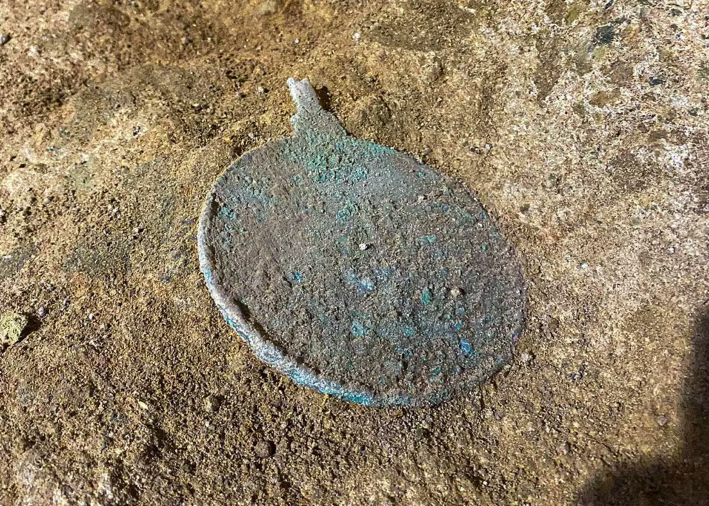
One chamber held a peperino sarcophagus and urns accompanied by grave goods—ceramic vessels, a mirror, and finely made tableware. The second tomb, built slightly later, featured stone benches for multiple burials. There, archaeologists identified the remains of an adult male whose skull bears clear evidence of surgical drilling, a rare and valuable indicator of early medical intervention in Republican Rome.
Researchers believe the tombs were once united by a monumental façade of tufa blocks, implying ownership by a wealthy and socially prominent suburban family.
Two Vast Basins, One Persistent Mystery
If the tombs speak to memory and lineage, the site’s massive basins pose questions that remain open. The larger, eastern basin stretches about 28 meters in length and 10 meters in width, reaching over two meters deep. Built in the 2nd century B.C., it was later abandoned and finally sealed toward the end of the 2nd century A.D.
Plastered walls, a tufa cornice, side niches, and a large dolium embedded at one end confirm that the basin held water, yet its exact function remains debated. Ritual use, industrial activity, or large-scale storage are all under consideration.
Nearby, a second basin cut deeper into the tufa—around four meters—features irregular stone lining and a double ramp system. Unlike the first, it lacks clear hydraulic channels, making interpretation even more challenging. Comparisons with similar basins at Gabii have raised the possibility of ceremonial or sacred use, but definitive conclusions remain elusive.
Rome Beyond the Monuments
“These discoveries show that Rome’s modern suburbs still hold deep historical memory,” said Daniela Porro, Special Superintendent of Rome, emphasizing how sites like Pietralata expand the narrative of the city beyond its monumental center. Archaeologist Fabrizio Santi described the tombs and basins as opening “exciting research scenarios” into how ancient Romans structured ritual, movement, and everyday life at the city’s margins.
Excavations at Acacia Park 2 are set to continue, alongside plans for public presentation and heritage integration. For now, the findings offer a rare, ground-level view of Republican Rome—revealing not emperors and forums, but roads worn by carts, families laid to rest in stone, and sanctuaries where travelers once paused to honor a god.
Special Superintendence of Rome
Cover Image Credit: Special Superintendence of Rome.