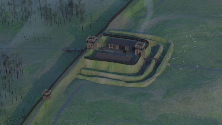
Archaeologists have uncovered the remains of a previously unknown Roman fortlet beneath the back gardens of residential homes in Bearsden, near Glasgow, shedding new light on the defensive system of the Antonine Wall, the northernmost frontier ever built by the Roman Empire in Britain.
The discovery, revealed in newly published research by GUARD Archaeology, emerged during archaeological investigations carried out in 2017 in the gardens of three neighboring properties along Boclair Road. What began as routine work ahead of residential development unexpectedly exposed the stone foundations of a structure that once formed part of Rome’s frontier defenses in Scotland.
Unexpected Discovery Beneath Modern Homes
The archaeological investigations were funded by the homeowners themselves and carried out as a requirement of planning permission imposed by East Dunbartonshire Council. Excavations quickly revealed the kerbed stone base of a turf rampart, an architectural feature typical of the Antonine Wall.
Recognizing the potential importance of the discovery, Historic Environment Scotland commissioned additional excavations and geophysical surveys in the area.
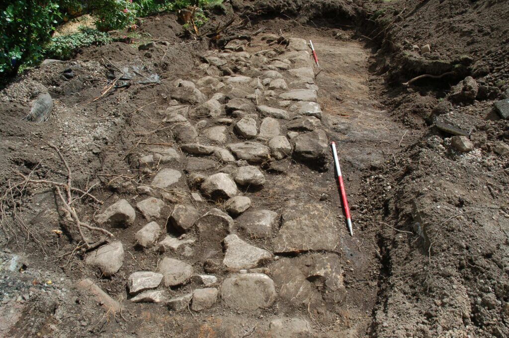
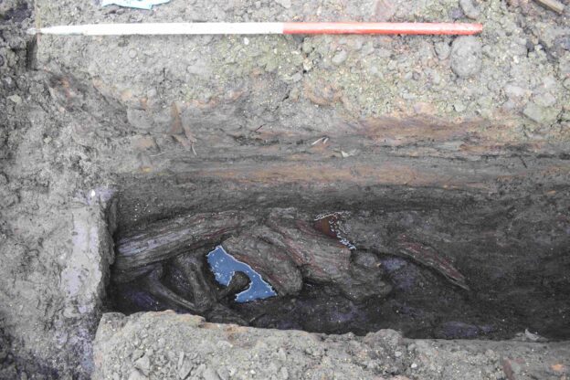
These investigations uncovered a parallel ditch running alongside the stone base, containing preserved organic remains such as peat, wood fragments, and plant material. Geophysical survey results also indicated the presence of buried stone features that may represent surviving fragments of the Antonine Wall itself.
What made the discovery particularly notable was the orientation of the remains. Both the stone base and the ditch ran perpendicular to the line of the Antonine Wall, suggesting they belonged not to the wall itself but to a separate structure linked to its defensive network.
Evidence of a Roman Frontier Outpost
Radiocarbon dating of wood recovered from the base of the ditch placed the structure between AD 127 and AD 247, firmly within the period when the Antonine Wall was constructed and occupied. Two fragments of Roman pottery were also found beneath the stone base, further supporting the interpretation of the site as part of a Roman military installation.
Researchers concluded that the remains represent a previously undocumented Roman fortlet, a small outpost designed to support the larger forts that lined the frontier.
The fortlet occupied elevated ground directly beside the Antonine Wall, providing clear views across the surrounding landscape. From this vantage point Roman soldiers could monitor territory to the north—land that remained outside Roman control—and maintain visual contact with the larger Roman fort at Bearsden located nearby.
Such positioning strongly suggests the fortlet functioned as part of a surveillance and early-warning network, staffed by small detachments of soldiers sent from nearby forts to patrol the frontier.
Life on the Edge of the Roman Empire
Specialist environmental analysis has also offered a glimpse of what the landscape looked like when the fortlet was built nearly two millennia ago.
Botanical remains and fossil beetles recovered from the ditch sediments reveal that the surrounding area consisted largely of open pastureland interspersed with partially cleared woodland. The woodland was dominated by alder, hazel, and willow trees, with smaller quantities of oak and birch. Grasses covered the cleared areas, indicating grazing land likely used by local communities or military livestock.
A Frontier Built for a Short Time
The Antonine Wall itself was constructed shortly after AD 142, during the reign of the Roman emperor Antoninus Pius, from whom the wall takes its name. Stretching roughly 63 kilometers across central Scotland, it marked Rome’s northernmost attempt to control Britain.
Unlike the stone-built Hadrian’s Wall further south, the Antonine Wall was constructed primarily from turf placed upon a stone base, with a large ditch running along its northern side.
However, the Roman occupation of the frontier proved relatively brief. By the AD 160s, little more than twenty years after its construction, Roman forces withdrew southward and reoccupied Hadrian’s Wall.
Archaeology in Unexpected Places
The discovery beneath suburban gardens highlights how important planning-led archaeology has become in identifying previously unknown historical sites.
Researchers note that the remains uncovered at Boclair Road demonstrate how even small areas of modern development can preserve important evidence of the Roman frontier.
What once stood as a military outpost guarding the northern limits of the Roman Empire now lies quietly beneath the lawns of modern homes—an extraordinary reminder that traces of ancient history can survive in the most ordinary places.
Cover Image: The Boclair Road Roman Fortlet as it may once have been, by Eduardo Pérez-Fernández © GUARD Archaeology Ltd