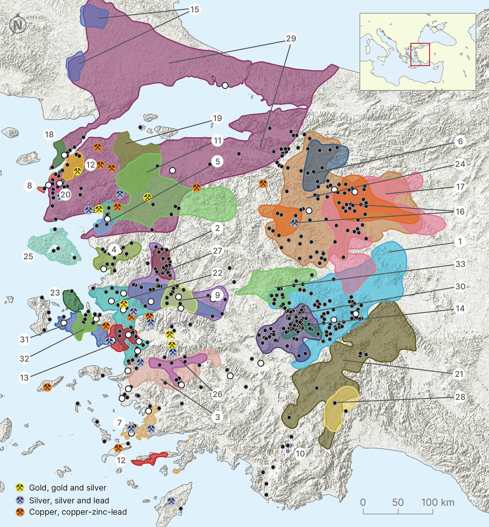
For much of modern scholarship, the Luvi cultural landscape of western Anatolia has been reconstructed through fragmented excavation reports and a limited number of well-known sites. A recently published digital study now brings this scattered evidence together, offering the first truly regional perspective on Middle and Late Bronze Age settlement patterns across the area.
Covering the period from roughly 2000 to 1200 BCE, the research assembles settlements from western Anatolia into a standardized, interoperable dataset. Rather than treating the Luvi world as a constellation of isolated centers, the study reveals a dense and interconnected settlement network that reshapes our understanding of the region during the Bronze Age.
A Decade-Long International Research Effort
The study was published in Scientific Data, a peer-reviewed open-access journal of the Nature. It was conducted by an international team of scholars including Eberhard Zangger, Fred C. Woudhuizen, Serdar Hakan Yalçın, and Christoph Bachhuber, all of whom are well known for their work on Anatolian and Aegean prehistory.
The project was carried out in collaboration with researchers from the Turkish Ministry of Culture and Tourism and the Switzerland-based Luwian Studies Foundation. Together, the team undertook an extensive ten-year meta-analysis aimed at collecting, evaluating, and digitizing all available archaeological information related to Middle and Late Bronze Age settlements in western Anatolia.
Rather than generating new excavation data, the researchers focused on synthesizing decades of published reports, survey results, and archival studies within a single, coherent methodological framework.
Reconstructing the Luvi Settlement Landscape
At the heart of the study lies a digital catalogue comprising 483 Middle and Late Bronze Age settlements distributed across western Anatolia. Each site is documented using standardized criteria, including geographic location, chronological attribution, settlement type, and levels of archaeological reliability.
This approach addresses a long-standing gap in Luvi studies. While the Luwians are well attested through textual and linguistic evidence—particularly in Hittite sources—the spatial organization of their communities has remained difficult to assess at a regional scale. The new catalogue moves beyond major centers such as Troy, Beycesultan, and Liman Tepe, revealing a far broader and more nuanced settlement landscape.
From Prominent Centers to Regional Networks
By integrating excavation data, systematic surveys, and legacy publications, the dataset illustrates how settlements were distributed across plains, river basins, and coastal zones. The emerging picture emphasizes regional connectivity rather than dominance by a small number of urban hubs.
This spatial perspective allows researchers to explore how Luvi communities interacted with one another, how regional identities may have formed, and how western Anatolia functioned as a cultural and economic corridor between the Aegean and inner Anatolia throughout the Bronze Age.
A New Infrastructure for Digital Archaeology
One of the catalogue’s defining features is its compatibility with international digital research infrastructures. Designed to integrate with geographic information systems and global archaeological gazetteers, the dataset enables comparative and interdisciplinary research well beyond Anatolia.
For Luvi studies in particular, this opens new avenues for reassessing debates on cultural boundaries, political organization, and regional interaction networks during the Bronze Age.
Why the Luvi World Matters
The significance of this project lies less in proposing a new historical narrative than in providing the foundation upon which such narratives can be built. By presenting settlement data in a transparent, reusable, and methodologically consistent format, the study makes it possible— for the first time— to analyze the Luvi world at a genuinely regional scale.
As such, the digital catalogue is poised to become a key reference point for future research into one of Anatolia’s most influential yet still imperfectly understood Bronze Age populations.
Cover Image: Relief map of western Türkiye showing archaeological excavations (white dots), settlement sites (black dots), areas covered by archaeological surveys, and archaeologically attested ore deposits . Credit: Scientific Data (2025). DOI: 10.1038/s41597-025-06241-9